It was time for a long walk and a glorious day, full of frost and sunshine with a nip in the air; my favourite sort of day.
I parked at a small parking spot off the A913 near Glenduckie. Tim and I had parked here when we did Norman's Law in February. Today I was going to head in the opposite direction Or was I? I can't now remember why I set off in one direction and turned round to go the other way round, but I know I did. I crossed the A913, walked up the road to Glenduckie and stopped in my tracks, turned round and went the other way, clockwise. Perhaps it was my eagerness to reach a new gridsquare as soon as possible.
I soon went 'under' a railway bridge. This time it was part of the erstwhile Newsburgh and North Fife Railway. The line was just over 13 miles in length and inked Newburgh with St Fort. It opened in 1901 and closed in 1964. For more information about the line see
here.
 |
| Former railway bridge at Dunbog. NO2818 |
The sun hung low and shone faintly through the trees onto the glistening road.
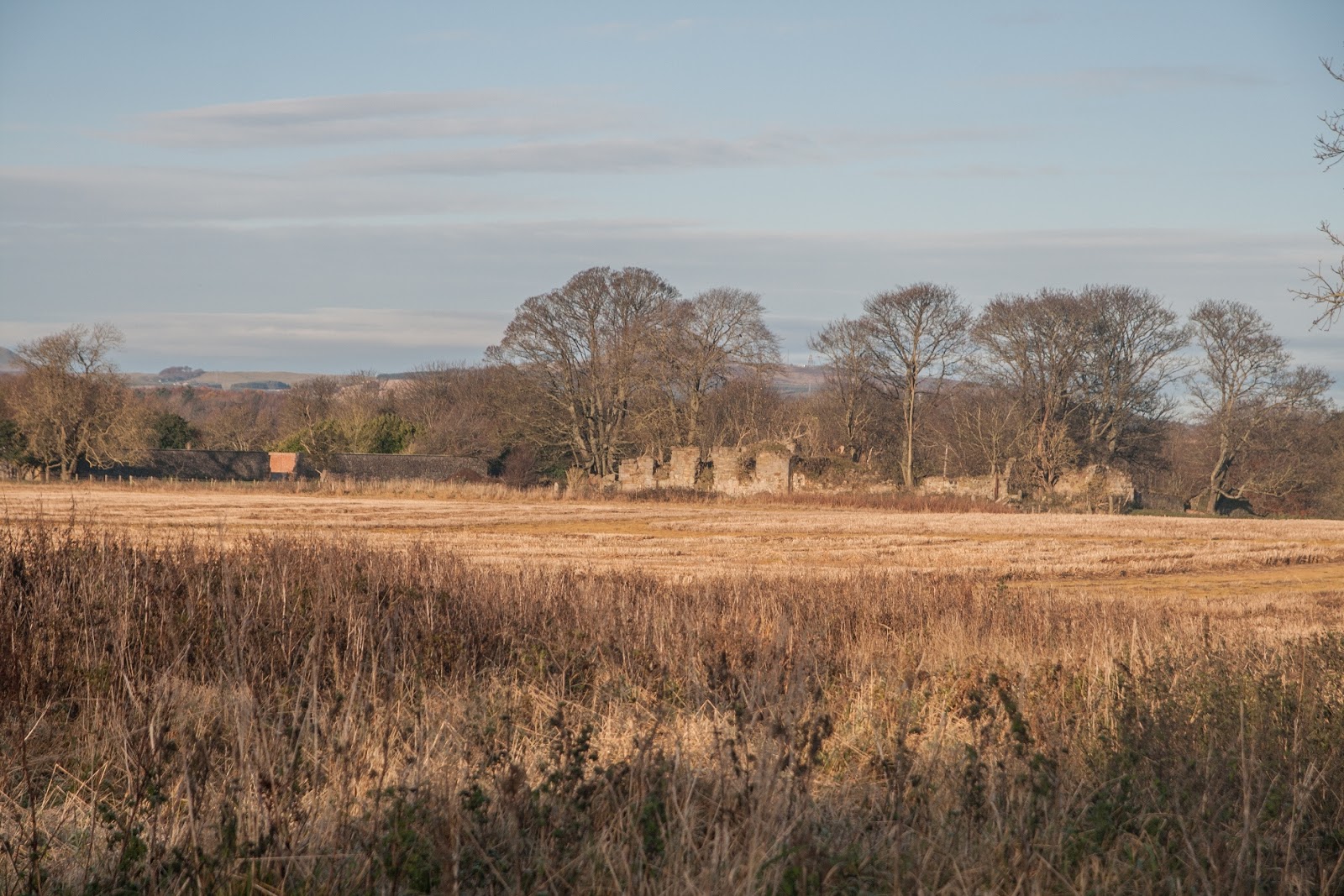
 |
| Approaching Dunbog. NO2818 |
I looked back to glorious lighting over Norman's Law.
 |
| Norman's Law from NO2818 |
NO2818 was turning out to be a contender for top ten gridsquares in Fife. I happened next upon a little cemetery, nestled quietly amongst the trees. I spent a few moments wandering between the graves, absorbing history and sunshine and autumn.
 |
| Dunbog cemetery. NO2818 |
Apparently Dunbog house once stood here on the site of the Preceptory of Gadvan. What a fascinating name. The preceptory and former church belonged to Balmerino Abbey. At the Reformation the church became the parish church until 1803 when a later church was built to the south-east. I think this is now a dwelling house. The name Gadvan remains a mystery. I'd hoped it was some ancient knight of the order of Sir Arthur, but apparently not. The 'gad' element probably refers to the type of willow used for basket making, whilst the 'van' element is unknown.
I photographed the later church as I walked past, and then Dunbog Farm.
 |
| Dunbog Church. NO2817 |
 |
| Dunbog Farm. NO2817 |
I walked the length of NO2817, passing a perfectly formed U-haped loch en route to the next gridsquare.
 |
| U-shaped loch near Dunbog.from NO2817. (Loch actually in NO2717) |
As I followed the gentle contours round the western side of Dunbog Hill, I looked westwards to reedbeds I remembered seeing with Tim in July on another walk. We had discussed their merit as a bird reserve and decided it was good! Now all we needed was probably lots of cash and the power of persuasion to get however owned the land to sell it to us for a pittance.
 |
| Reedbeds near Lindores. NO2716. |
I was in this dream world where Tim and I owned our own bird reserve with Bitterns and Bearded Tits, Water Rail, Little Egrets, perhaps a Spotted and even a Little Crake, when I heard the sound of a cycle bell behind me. A cheery chap greeted me as he cycled with ease up the hill. "I just love mornings like this," he shouted. "I did the same route yesterday, but it was just too nice to stay indoors today, so I decided to do it the other way round instead." I dittoed his enthusiasm and my heart felt gladdened for this brief encounter. I love meeting such positive, life embracing people. Far too often people are focused on the negative; sometimes we don't even know we're doing it, we're drawn into it, like a fly to a spider's web so that before we know it, we are entangled in negativity which we didn't even see coming. That's how I feel about work sometimes (most of the time actually!)
 |
| Where I met the cyclist. NO2816 |
I'd no doubt the cheery cyclist would not be going the same way as me for long as I was striding out to the top of Dunbog Hill. I hadn't done this on my walk with Tim in July as it is totally gratuitous and unless you are collecting trigpoints, there is no point in wandering gratuitously uphill, unless of course the view is worth it.
 |
| Dunbog trigpoint. NO2816 |
As you can see from the photo, the trigpoint is a little damaged. There was certainly a good view from here. The photo shows the view westwards to Lindores Loch.
 |
| Lindores Loch from Dunbog Hill NO2816 |
Having bagged my trig, I descend the way I'd come and then took the path Tim and I had taken in July down to Lindores Loch, only this time, like the cyclist, I was doing it the other way round.
 |
| Descending to Lindores Loch. NO2716 |
At the B937 I was turning the opposite direction to the one I'd been with Tim - right, not left. I walked past the Lodge and realised I didn't now need to walk along the windy road, which was a relief; there was a footpath through the woods here.
 |
| Lindores Lodge. NO2716 |
I took a photograph of the Loch before turning onto the footpath. I saw Wigeon, Tufted Duck, Mute Swan, Mallard and Moorhen on the Loch.
 |
| Lindores Loch. NO2716 |
The path runs parallel to the B937 until it emerges at its junction with the A913. It is a lovely path through mixed woodland.
 |
| Lindores Woodland. NO2616 |
Emerging onto the A913 was not pleasant, but my walk along this busy road was short-lived. Soon I turned left towards Grange of Lindores where I crossed a modern railway bridge.
 |
Railway bridge at Grange of Lindores. NO2516
|
I went to look at Abdie Church, but resisted the temptation to go and see the ruins of a much older church at the western most banks of Lindores Loch and not far from where I was. This would definitely be something to return to. I haven't been able to find out why the church is called Abdie and not Grange of Lindores. I can only assume the village used to be called Abdie.
 |
| Abdie Parish Church. NO2516 |
I walked to a T junction and turned right into the village of Grange of Lindores and then left at a Y-shaped junction to join the B936.
 |
| Y-shaped junction at Grange of Lindores. NO2516 |
It was an uphill slog for a bit until I turned right again towards Ormiston Farm. I'm always glad to get off the road. I just can't enjoy walking when you're anticipating having to pull over for traffic all the time.
 |
| Road to Ormiston Farm. Ormiston Farm Cottages on left. NO2416 |
The world continued to be soaked in sunshine with not a cloud in the sky; a truly serene day and I was loving that serenity and the Adrenalin induced by the sense of exploration. I don't need to climb Everest or row across the Atlantic or come up with some other extreme 'first'; I'm happy concocting my own walks and not following somebody else's route. That gives me enough Adrenalin, plus looking for benchmarks, flora and fauna and a wealth of history besides.
Such was my state of mind as I walked along this farm road, pausing to say hello to a large herd of sheep.
 |
| Sheep at Ormiston Farm. Looking towards Grange of Lindores. NO2416 |
I spied a Grey Wagtail just before Ormiston Farm, which was a lovely surprise. There are a few burns hereabouts I suppose. As I passed Ormiston Farm, a farmer drove past on his quad bike with his two kids and collie. He stopped to say hello and I checked that I was going in the right direction. I wasn't. As I've said before, I don't like it when people ask where I'm heading because I often don't know. This time I did though; I knew I was heading towards Newburgh and he pointed me in the right direction.
I hadn't long turned onto the path he'd shown me when he drove up behind me again. "I notice you've got binoculars," he said"Have you seen any rare birds round here?" Delighted to have found someone interested enough to have taken time out from his busy day to make a diversion to ask me, I told him I'd seen tree Sparrow and Grey Wagtail, which, though not 'rare' in themselves were always a joy to see and that Tree Sparrow is is national decline. I wish I'd known when talking to him that it is in fact one of five species with a long-term decline of 90% or more. That is really worrying and so very encouraging to have seen it here. He said he was trying to make his farm more biodiverse and would be interested to know if any 'rare' species were seen here. I said I would let him know if I saw anything really rare as he didn't seem interested in the meagre sparrow and wagtail.
Heartened by this conversation, I continued on the path as far as it allowed, to the gates of Clatchard Craig Quarry, a bit of a scar on the landscape.
 |
| Clatchard Craig Quarry. N02417 |
Here I turned left and straight up Ormiston Hill from whence a splendid view of the Tay is beheld.
 |
| Newburgh, the Tay and Norman's Law in the distance. From NO2317 |
It might be a splendid view of the Tay, and my heart might be pounding with ecstasy within my chest, but it wouldn't do for my requisite photograph of NO2317. I needed something more local, and, in this case, more mundane.
 |
| Descending to Newburgh from Ormiston Hill. NO2317 |
I had made my mind up to have lunch by the shores of the Tay. It was quite late for me to be eating lunch at 1.20 pm, but I just hadn't found a suitable spot before. It's always quite difficult finding somewhere relatively comfort to sit. My criteria for lunch are as follows:
1) Between 12 noon and 1 pm.
2) Somewhere comfy to sit
3) With a view
4) Somewhere sheltered and quiet
5) With no-one else in sight as far as possible
6) With nothing unsightly or foul-smelling in view or in the air
Today's lunch spot fulfilled only no 3 of my criteria. I perched on a cold step, although you could argue my posterior was warmed by the comfort of my trusty red foam sheet that lives in my rucksack for such occasions (also useful for crossing barbed wire fences). I was in full view of many dog walkers, thus 4) and 5) and possibly 6) were being breached and obviously, being 1.20 pm no 1 had also been breached. Still, no 3) made up for it!
 |
| Pier at Newburgh, NO2318 |
I rushed my lunch, for all the reasons above, but mainly because my fingers were too cold to remain out of my gloves for long, then proceeded eastwards. A strange figure took my eye in the fields on the hill to my right.
 |
| The Newburgh Bear from NO2318 |
The bear was cut for a community project in 1980 and is believed to be a depiction of a stone called the bear stone,which was originally set into the abbot’s residence at nearby Lindores Abbey (another place I must visit). For more information about the bear, see here.
I photographed a bench for NO2418, positioned in a more suitable lunch spot than the one I had chosen!
 |
| Bench by the Pow of Lindores. NO2418 |
Apparently vessels used to lie here on their way up river to Perth. From at least 1600 a ferry used to cross the Tay between Lindores to Errol on the opposite side. See Canmore's excellent site for more details.
From here I followed the path inland, passing Parkhill Mill, crossing the road and turning south towards Old Parkhill.
 |
| Parkhill Mill. NO2418 |
 |
| Old Parkhill. NO2418 |
I had seen quite a few people walking today and stopped to speak to most of them. Of course, naturally I seek solitude on such occasions. I don't mind meeting people walking in the opposite direction because I know I'm going to get rid of them quickly, but it's a bit more awkward if you're kind of going the same pace as someone walking in the same direction. Do you keep pace with them and chat? Not a good option, but does it look rude to stroll on them past them with not much more than passing the time of day with them? I'm never sure and usually judge from the reaction to my initial greeting as I casually walk past them or let them overtake me (probably my preferred option).
Today, I stopped to speak to a couple with a dog (I forget which breed). We discussed which way the Fife Coast path went as it had turned inland. I explained that my map was old and didn't show the Fife Coast Path so I wasn't sure, but was just going to follow my nose. I overtook them, thinking they might overtake me whilst I was engaged in photography somewhere, but, in fact, I didn't see them again.
I walked across a stubble field to Old Parkhill, where some workers were busy with noisy machinery and I waved hello to them.
 |
| Stubble field from Old Parkhill, looking towards Parkhill. NO2418 |
The views were glorious on this perfect autumn day.
Newburgh and River Tay from NO2518
But what was this I beheld before me? A ruined castle? How come I'd not noticed this on my pre-walk reccie?
 |
| Ballinbreich Castle from NO2518 |
I consulted my map and discovered it must be Ballinbreich Castle, which is actually in NO2720 and not on my walk today - but another time . . .
For my requisite photo, I turned to the shade and the disused quarry on Silver Hill.
 |
| Disused quarry, Silver Hill. NO2518 |
I was loving this amble along the Tay, albeit at some distance, but that allowed for expansive views and the nip in the air was invigorating. I walked on towards Silver Hill with its line of Pine Trees.
 |
| Pine Woodland on Silver Hill. NO2618 |
The sunlight filtered through the sparse trees, creating a stunning dappled effect.
 |
| Silver Hill Woodland. NO2619 |
The islands on the Tay were distinctly visible from up here. What a perfectly beautiful place to be grazing.
 |
| Grazing on Higham Hill. NO2619 |
 |
| Grazing on Higham Hill. NO2719 |
Just before Old Higham the path turned inland once more and I was sad to be leaving the coastal views, but glad to be nearing my car after nearly 12 miles out in the cold. A path turned towards the coast from here, pointing towards Ballinbreich Castle, so I knew where to return to at a future date.
I passed Old Higham Farm, glowing in the late afternoon sun and then, in the next gridsquare, Higham Farm Cottages.
 |
| Old Higham Farm. NO2719 |
 |
| Higham Farm Cottages. NO2718 |
Now I was back where I'd started, where I'd turned back over five hours before. I seemed to have been walking for much longer than five hours, but I usually cover about 2.5 miles in an hour, so that worked out about right. It had been one of my favourite walks with plenty to return to - perhaps on a warmer day. The last photo of the day goes to Glenduckie Hill, guarding the village of Glenduckie and absorbing the last of the winter's day's apricity.
 |
| Glenduckie Hill from NO2719 |
Number of new gridsquares: 12 (I had first bagged 4 others on previous occasions)
Number of miles walked: 11.7
Walk worth repeating: YES, omitting ascent to Dunbog trig, visiting Abdie old church, Lindores Abbey. Another walk will have to include Ballinbreich Castle and adjoining squares.
Highlights: sunshine and frost, Fife Coast Path, Tree Sparrows, Grey Wagtail, meeting enthusiastic farmer, path at Lindores Loch. autumn colours and lighting.