In contrast to last week's weather, today was beautiful and I welcomed back that feeling of anticipation I used to get whenever I embarked on one of my long walks. It's a mixture between fear and anticipation. I'm a little apprehensive that all might not go to plan - and it never does 100% of the time - but, at the same time, that's what makes it so exciting. Some people prefer to follow an assigned route and I'm just not one of those people, I like to pore over the map both before and after the walk to make sure I'm not going to miss anything of interest. Even this method is not foolproof.
Anyway, when I walked up Kellie Law in February I had been tempted to extend the walk to Carnbee as there was a church marked on the map. I'd resisted the temptation however and, since then, I have been anxious to return to the area to investigate the church. I'd drawn a route and synced it to my phone - if that's a word! I'd checked google map satellite where you drag the wee yellow man onto the map so you can see a 3D picture of the area you're interested in - and yes, it looked like you could park at the church.
 |
| Carnbee Church - NO5306 |
As usual, it took me ages to get booted up and ready. I had already turned my old phone on and checked the map, but now when I did so again the map was still there, but the route I'd synced had disappeared. I switched my phone off and back on again and tried every trick I knew to make it reappear - and, let's face it, there aren't many! But it wouldn't reappear. I thought there was nothing else for it but to try and remember the route and I was surprised to discover that I could remember it. I wouldn't be able to check the benchmarks of course, but that didn't matter too much. I'd just have to look harder for them whilst walking.
Having had a quick look round the churchyard and not seeing any obvious graves of particular interest and being keen to get started as I'd wasted some time agonising over the 'lost' route, I set off [ast the school and Carnbee Farm where I turned left towards Kellie Law.
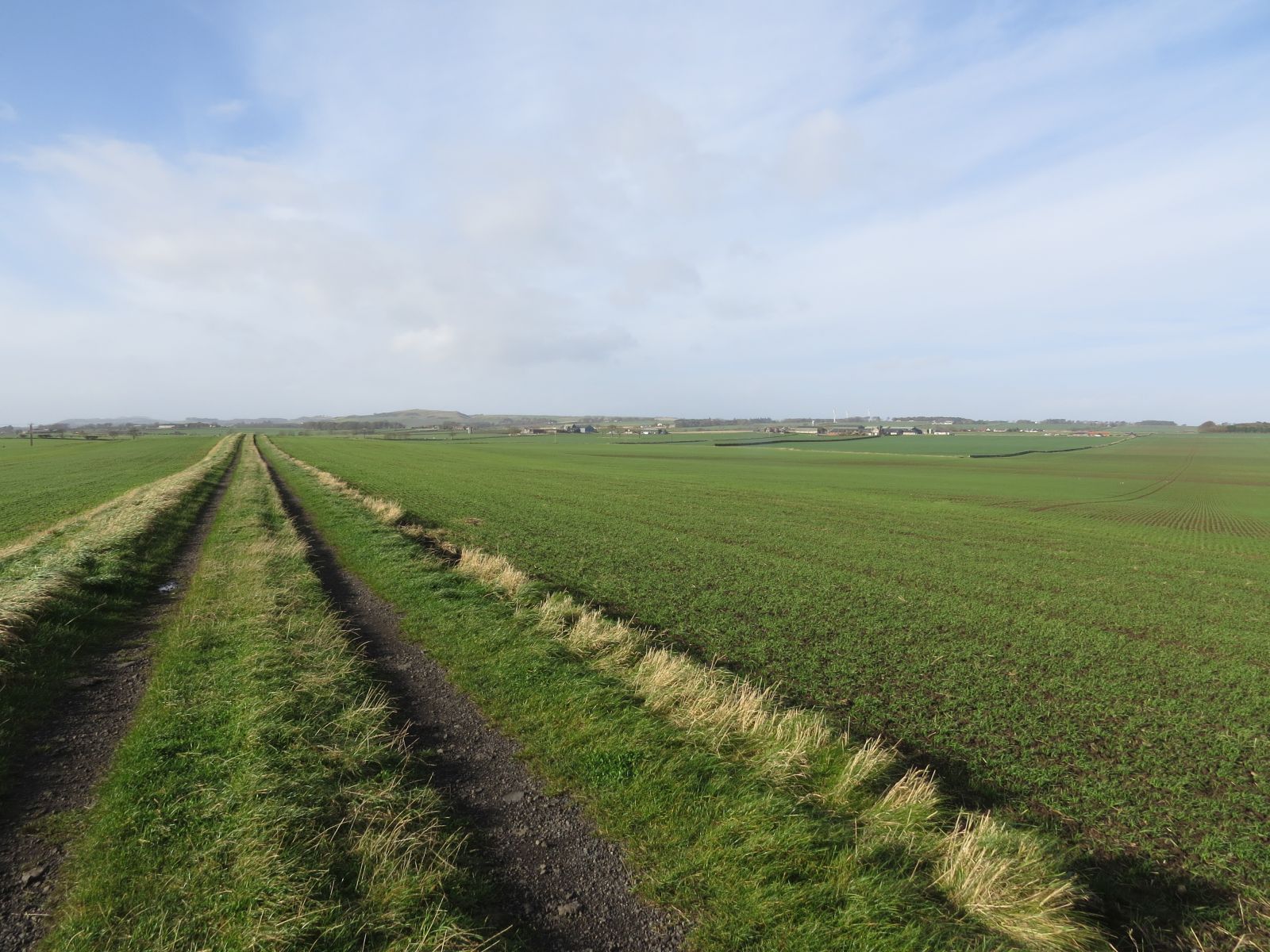
 |
| Track to Kellie Law. NO5206 |
Entering the next gridsquare I felt like this was not new territory, even though I was on a different footpath for nearly half of the square's length. I trod cautiously along the muddy path once I met the path I'd walked last time. "I could very easily slip here," I thought to myself. Picking my way through a ridiculous amount of mud I managed to get to a slightly less muddy part of the field, where I disturbed what I think was a Jack Snipe. t'he bird did not fly until I was virtually on top of it, was silent and made a beeline for a clump of juncus not far from where it had flown. Try as I might I could not see it again. I texted Tim. "Could it be a Jack Snipe?" I asked. "Very likely," was his reply. So there are some rewards for slipping and sliding your way through copious mud.
Looking at my routeless map, I oculd not remember whether I had opted to continue north along the road and turn at Knights Ward or turn left to South Baldutho, then right to head north past North Baldutho. I opted for the latter as I don't really like walking along the road. I didn't take any photos of the squares I had already photographed and walked quite quickly while I could, still conscious of the time I'd lost trying to 'find' my 'lost' route on my phone.
I counted 23 Mallard on Gillingshill Reservoir. I did not pause long here but thought it would have to do better than that to earn the title of Nature Reserve. Perhaps more wildfowl will yet arrive.
I was glad to reach the end of the boarding kennels with only one dog barking at me. This was where I entered new territory. Last time I had headed south; this time I was heading north. I turned right and followed a good track which suddenly petered out in a thicket of gorse bushes. Another track led westwards, but I didn't want to go in that direction. I went for a quick reccie to see if my desired path really was impenetrable. The verdict came back unclear so I erred on the side of caution and plumped for the westwards track.
I had been in this square before. It was the Baldutho Quarry square and I was now in the more northern sector of the square, but I didn't want to go any further west. As soon as I could I climbed a very rickety, held together with pieces of string fence and followed the field edge round to where I hoped I would meet the unobstructed path I'd left earlier.
 |
| The westward path I did not wish to follow. NO4906 |
Looking at the map I was 'joining' two broken pieces of dismantled railway, the old East Fife Central Railway. I had to clamber over a barbed wire fence (there were a few of them on this walk), but I had done it - I'd rejoined the path and was now at a ruined railway bridge and a delightful rippling burn.
 |
| North Baldutho Railway Bridge. NO5007 |
With blue skies overhead and the sound of the burn I decided to pause here for a well earned cup of tea. I was actually in the same gridsquare as Knights Ward, which had formed part of my aforementioned Largoward walk back in February. I revelled in the sunshine and in my achievement so far (yes, I know I'm bragging about very little) and hoped I'd be able to get past North Baldutho without any further trouble.
 |
| North Baldutho from the south. NO5007 |
Fortunately, I had no further trouble with disappearing tracks. North Baldutho farmstead is now a ruin (second from left) with various farm buildings on the site and a new build visible on the above photo (extreme left). I love ruins and thought I might investigate this one with the curious eye of a benchmark hunter (by the way I'd also looked at the railway bridge - to no avail - and was glad I didn't spend longer on that search as I discovered later there wasn't one there or at North Baldutho).


 |
| North Baldutho farmstead. NO4907 |
For all my delight in the new territory I'd walked through, my last 'new' gridsquare was five gridsquares ago and I was eager to enter a new one. A Stonechat flew close to say hello and hung around for a while to keep me company.
 |
| Stonechat |
I passed the crossroads which had caused me some confusion on my Largoward walk in February. I had now walked down each trajectory, including the northern end of the one which had caused me a problem earlier in the day between North and South Baldutho. I was keen to see if this was indeed passable but that would have to wait for another day.
As I approached the B940 I entered new territory and took a photo of the farm sign for North Baldutho, a poignant pointer to days gone by when no doubt the farmhouse had been inhabited by those who farmed the land.
 |
| North Baldutho farm sign. NO4908 |
Later, when I checked my original intended route, I realised I planned to turn right at the B940 and then left to follow the Lingo Burn eastwards and then free range to South Kinaldy. The route I took involved turning left on the B940 and then right at West Lingo. Either route gained me just one new gridsquare. The route I ended up taking, though, did pass one of those attractive Fife milestones which I've inadvertently started collecting.
 |
| West Lingo Milestone with benchmark. NO4908 |
 |
| West Lingo milestone. West face. I love seeing the distances measured in eighths. Pitt'wm 5⅞ |
 |
| Context photo of West Lingo milestone. Looking west. NO4908 |
 |
| Track to Lingo House. I liked the home made speed restriction sign. NO4908 |
I anticipated the sight of the homestead moat marked in Old English font on my map and turned into a field entrance to gain a view just before an imposing sign saying Lingo House Only across a closed gate. "I'll deal with that in a minute," I thought. First to investigate the moat.
 |
| Medieval homestead moat at Lingo. NO4908 |
 |
| Ruin near Lingo House. NO4908 |
NO4908 had been an interesting gridsquare, but I had spent long enough in it. I now climbed the locked gate to Lingo House in fear and trepidation. Was I going to be accosted?
 |
| Lingo House. NO5008 |
I was still a little fearful as I crossed the field towards South Kinaldy, especially as I saw a tractor working away in the distance, but in my direction of travel.
 |
| Field towards South Kinaldy. NO5009 |
I arrived at South Kinaldy farmstead ruin where I had thought I might eat my lunch, but it was very windy and cold with nowhere appealing to sit, so I decided I would continue after having a nosey at the ruin.
 |
| South Kinaldy. NO5109 |
I was delighted to discover a very worn benchmark on this ruin.
 |
| South Kinaldy benchmark. NO5109 |
I had made a very slight detour to visit this building and realised afterwards if I had wanted to cut my walk short I could have continued along that track towards Chesters and turned south to Pittarthie Castle. This would be an option for a shorter walk. For now, I retraced my steps 50 yards or so and turned right through another gate along a good track towards Kinaldy Den where my hopes were high for a decent lunch spot.
I was to be disappointed, for not only was there no decent lunch spot, there seemed to be no easy access into the den so the waterfall marked on the map remained tantalisingly close, but out of reach, as did the burn and my photograph for this gridsquare was a boring one of a field of haystacks.
 |
| Harvest time at Kinaldy. NO5010 |
I walked through Kinaldy farmyard with no trouble, anticipating a barking collie at every step, but it seemed deserted. An old dovecot made an interesting subject for this gridsquare, as well as adding to my Fife doocot collection. This one is not marked on the map, but is described here.
 |
| Kinaldy Doocot, late 17th/early 18th century. NO5110 |
My thoughts were now turning desperately to lunch. Looking at the map, I realised if I didn't stop soon, I'd be on the road again with nowhere suitable to stop. But I did not want to stop by Kinaldy House, where someone had a bonfire in the 'garden'. I walked purposefully along the extensive driveway and decided I'd stop at the entrance where a veteran Oak provided a good back rest for my picnic stop.
 |
| Driveway to Kinaldy House. NO5110 |
I enjoyed the company of tits and finches whilst I munched on my cheese roll and then, feeling rested and refreshed I braved the next section of the walk. Again, I was pleased to discover the road was largely free of traffic, allowing me to photograph the next gridsquare at my leisure. It was one of those that I could easily have missed had I been having one of my less observant moments, as I was only in the square for a matter of yards.
 |
| Bannafield. NO5211 |
 |
| Turn off to Tosh. NO5211 |
The road stretched on and on and made for easy walking. I could see another worker ahead near Tosh. He was in one of those tiny diggers. We waved to each other as I passed and then I paused at a bridge.
 |
| The road stretched on and on. Looking towards The Brake. NO5210 |
 |
| Bridge over Kinaldy Burn and Wakefield Burn. NO5210 |
 |
| Kinaldy Burn. NO5210 |
 |
| Rivet on bridge over Kinaldy Burn. NO5210 |
I was in the next gridsquare for less than 1000 feet, so took a photo at the first opportunity.
 |
| Limelands Crossroads. NO5310 |
I turned right at these crossroads and walked towards Chesters along an avenue of trees.
 |
| Near Chesters. NO5309 |
I resisted the temptation to take any photos before I reached what I anticipated would be the highlight of my walk today - Pittarthie Castle. It wasn't really visible until I entered the field it was in; it is much more visible if you approach from the south. The Castle dates from the late 16th Century but is now a ruin. It is described on the historical portal here. I was its only visitor today and I sat on a wall with my final cup of tea of the day and decided to try a self-timer. It's not often I get a ready made tripod like a wall to put my camera on.
 |
| Self-timer at Pittarthie Castle. NO5309 |
 |
| Pittarthie Castle from the south. NO5309 |
I was nearing the end of my walk and could see my track stretching ahead of me towards Lochty Farm. I headed south across the Dunino Burn to join the track.
 |
| Lochty Farm track. NO5208 |
I met the farmer walking through the farmyard. I'm always a little apprehensive on these occasions lest they think I'm trespassing, but he greeted me warmly and commented on the weather. It just meant I couldn't snoop around looking for a benchmark!
I turned left onto the B940 and inspected another milestone for a benchmark. There was no benchmark, but it was still an attractive milestone. I wonder how many I have now in my 'collection'.
 |
| Milestone on B940 near Lochty. NO5208 |
I was glad when I saw the turn off to Carnbee and a sign that read 'Carnbee 1'. My estimate had been correct; I was getting good at guessing, or rather, estimating the miles I had left to walk. I was now in my final gridsquare of the day and took a photograph of the road in the beautiful late afternoon light.
 |
| Approaching Carnbee. NO5207 |
Even closer to the end of the walk, I caught more than a glimpse of Carnbee Reservoir (Private Fishing). For a moment I thought I heard a Water Rail squealing here, but, as it was unlikely and probably due to tiredness, I'm not going to count it. There was no other life visible on the reservoir, which, although in a different gridsquare, it was one I had photographed at the beginning of the day, so it wasn't a new one for me. I took a photograph anyway - it looked attractive in the warm late afternoon lighting.
 |
| Carnbee Reservoir. NO5206 |
I was back where I'd started. I'd done it without a drawn route. I felt quite proud of myself and I felt tired, but, more than anything, I felt elated as I always do on one of these low-key adventurous walks.
 |
| Back at Carnbee. NO5306 |
Number of miles walked: 12.2
Number of new gridsquares: 15
Number of milestones seen: 2
Number of Castles visited: 1
Walk worth repeating: yes, with option of going from South Kinaldy straight to Pittarthie Castle and then turning right before Lochty to get NO51 and (by short deviation) NO5107 and of retrying the North Baldutho track.
Highlights: North Baldutho ruin, Pittarthie Castle, ruined railway bridge near North Baldutho, Jack Snipe, Stonechat, South Kinaldy ruin.