Showing posts with label benchmarks. Show all posts

Thursday, 13 February 2025

Pivoting, riveting, flushing Kinglassie

Don't worry - all will become clear (about the title, I mean), but some of you may already have got it. Keep reading whichever category you  come into!

I agonise over a forecast before I set off on a gridsquare walk. When i'd first set aside today for my next one, the forecast had shown bright sunshine, but, by the day before, it had changed to up to 95 % rain. By that time, however, I was so looking forward to the walk that I was loathe to forego it. I checked three different forecasts and they all seemed to agree that it would clear up by 11 am.  I tried to wait that long before setting off, but it was too tough. I'm just not wired that way; if I don't get up and out by about 9 am I start losing motivation quickly.

I had cut today's walk by a third, from 12 miles to 8 miles and, after those 8 miles i wondered if I'd ever be up to walking 12 again, I was so tired and my feet hurt so much. (I haven't been able to figure out whether that's normal or not).

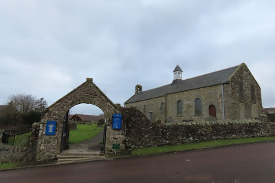
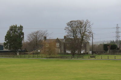
It was my second walk through the mining village of Kinglassie. My last one was in 2020 when I walked through it; this time I was beginning my walk there. I parked at the church.

Kinglassie Church - NT 2298

As per my last walk in Leuchars, I decided to leave the graveyard as a treat for my return to the car and set off north towards Redwells Farm. A footpath follows the Lochty Burn to Whinny Hall, but I continued northwards along a straight farm track uphill to Redwells Farm. The farmhouse stands in an elevated position and anyone looking out of the window could have watched my trudge all the way from Kinglassie to their house, and get ready to accost me upon my arrival there, for I didn't know which way I would take upon arrival.

Blythe's Tower was looming large. It was the second time I had seen it form afar, but I still had no reason to go right up to it as my first destination, East Auchmuir trigpoint was in the same gridsquare. There was not enough of interest there to tempt me to do a detour. Reading about it later, I learned it was a look out tower in WWII.

My trigpoint was west of Blythe's Tower so it would be better to continue walking west when I reached the farm, I decided. Obvious point, you may think, but this was a decision I arrived at after scouring the map and looking through my bins for any obvious access route up Redwells Hill. The track behind the farm led west so I followed thin onto the open hill and started climbing. The ground was muddy and slippy after recent rain, but I was keen to get out of sight of the farm so I plodded on as fast as I could, telling myself I would stop for a breather as soon as I reached the top of the hill.

The contours became more spaced out towards the summit and I paused at a ruin for a quick drink before continuing upwards to the trigpoint, which has its very own 'moat'. I leaned over precariously to touch the trig to officially 'bag' it!


Coffee break ruin, Redwells Hill - NT 2299


East Auchmuir trigpoint and moat with Blythe's Tower in the distance - NT 2299

Now, which way? I was heading south-west and this seemed easy enough and I started getting excited about my next two benchmarks, very close to each other, until my way was barred by a wall, an electric fence and two barbed wire fences. I walked the length of the wall to find a gate, but none could be found. I walked it again to find the easiest approach, hovering near a slightly raised lump of mud and the biggest gap between the electric fence and the barbed wire fence. It was now or never. Committing myself by flinging my rucksack over first, I placed my sitting mat on top of the barbed wire fence; it fell over to the other side. Remaining calm I gave the matter some thought. What had I got to use to cover the barbed wire? Aha, my scarf! My very long, tassly chenille scarf. bundling it up I placed it over the barbed wire and it immediately got caught in a dozen places, which I painstakingly liberated it from. I was going to have to do this the hard way.  It took some doing, but I finally got myself over that wall/fence combination, very glad that there was no-one nearby watching me.

I now had to walk back to the other wall, the one with the benchmarks. At first I could not see it and was just about to give up when a glinting piece of metal caught my eye. The rivet! I scraped some of the moss away (sorry, moss) to reveal the arrow and punched the air for joy. I had found my treasure and was likely the first person to set eyes on this little beauty for over 50 years.


East Auchmuir rivet on wall - NT 2199

My onward route looked obstacle free as far as I could see; no cattle, no fences or walls. Just straight down the edge of the field keeping my eye on the wall for the next rivet. Amazingly I found it. Wow! I was doing well today! I gave myself a mental pat on the back.


East Auchmuir rivet 2 - NO 2199


Location of second rivet - NO 2199

I wasn't so lucky with the third wall rivet, despite being determined to get three in a row! It simply evaded me and there's only so much moss clearing you can do without feeling guilty!

Reaching Kinninmonth Farm Cottages meant I had joined a tarmac road. No more barbed wire or electric fences from now on! The rain was just about holding off as I hovered round the end cottage here trying to be discreet looking for the next benchmark. This one was being guarded by a lucky horseshoe.  It was on a gatepost - another rivet. I was really enjoying myself!

The horseshoe guardian - rivet at Kinninmonth Farm Cottage gatepost - NT 2199

An auspicious moment was awaited: I was to cross the border from NT to NO (although I have to admit, I wasn't aware of the moment when I did so; I was too busy looking out for the next benchmark. I was only in the next gridsquare very briefly and there was not much nearby to photograph so I looked east and photographed Auchmuir Braes Plantation.


 Auchmuir Braes Plantation - NO 2100

Looking in vain for another rivet, I moved on quickly to the next stage of my walk - the busy road. I didn't k now it then, but the peaceful part of my walk, all two miles of it, had come to an end. There was to be brief respite for a further mile or so later, but for now I was flung onto a busy road. I have a new policy when encountering roads, busy or otherwise.  Look for an alternative route, preferably not too much of a detour. My determination to do this depends mainly on the busyness of the road in question. Is there a field or wood by which I can walk parallel to the road? The answer to this question on this occasion was a resound "No!" 

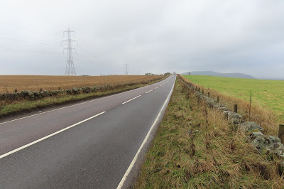
No escape - road at Craigend Hill - NO 2000

Not even bothering to look for the next benchmark I all but ran the next 50 yards or so until I reached the straight bit of road in above photo and felt slightly safer with even the option of the field on the right to walk through, which I did. In this way, hopping form one side of the road to the other, depending on which field was accessible. In this criss-crossing manner I had crossed once more back in the land of NT, having spent all of two gridsquares in NO. 

I spent ages looking for the next benchmark as it was safe to do. According to OS benchmarks it was on the west side of the road and the north side of the wall which meant I was safe in my search and hidden from oncoming traffic. To no avail! This one didn't want to be found either.

There was a nasty corner before Craigend and I took a slight detour into a patch of woodland which led down into Craigend Farm. A young man in his late teens was standing at the wall of the house, just where I needed to look for the benchmark! I wasn't missing out on another one for the sake of a bit of courage.

"Excuse me. Do you know if this property has a benchmark on it please?" I enquired. The young man looked at me as if I was speaking in a different language. He replied but I didn't understand him either. "This way?" I pointed to what i thought looked the most likely building and started wlaking towards it. "Ask my dad," he said again and pointed to the front door of the house.  Dutifully I knocked and awaited an answer from someone who looked vaguely familiar, although the feeling obviously wasn't mutual so I assume I didn't know him really.

I repeated my request to this middle aged man, father of aforementioned young man. In a friendly voice, he said he'd show me. "I'm sure I can find it," I urged but he was already putting on his boots and coat. "It's just the dog," he explained, pushing the collie into another room and shutting the door gently.

The benchmark was on the side of his house and finding it would have otherwise involved trespassing into his garden, so I was glad I'd asked.  This one is high up - over a metre above ground level, wihch is quite unusual for benchmarks.  After a short chat about the history and logic behind these marks, he wished me well on my walk and I wandered off, back onto the main road.


Benchmark, Craigend Farm/House - NT 2099


Craigend - NT 2099

Taking advantage of fields, I continued walking down this busy road.  Fortunately there were conveniently positioned exit and entrance points, so I could nip out of the field to look for the next two benchmarks, both of which were in the next gridsquare, and both of which were easy enough to spot.
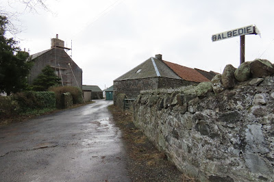
One was on East Belbedie Farm and the other, a flush bracket, on Balbedie Farm.


Benchmark, East Balbedie Farm - NT 1999


East Balbedie Farm - the building with the benchmark - NT 1999


Balbedie Farm - NT 1999


Balbedie Farm flush bracket - NT 1999

For anyone who has not given up reading yet, are you beginning to see the reason for my post's title? I understand that probably it's been a bit tedious. All I've talked about is gridsquares and benchmarks, which are definitely a bit well, niche, but that's what this blog is all about. And, to be honest, there wasn't a lot else to say about today's walk.  But I had collected 2 flush brackets, 3 rivets and 2 cut marks. That was above average for one of these walks. Now can you see the reason for my excitement?

I was now about to cross Fife's boundary into Kinross-shire, another exciting moment.


Cheerio Fife and hello Kinross-shire - NT 1999

In the photo, you can see just opposite the car, a turning to the left. What you can't see is the car transporter and various cars that had been sitting there since I'd left Balbedie. It was making me a bit nervous. I had to turn down that road, just for the tiniest wee bit just to get another gridsquare. I would be in the same gridsquare later on, but I wouldn't be in Fife. I also had to take a photograph of the right road, the left one, when I did reach a certain point within the gridsquare. perhaps you can see why i often go alone on these walks!

I walked brazenly past a host of signs which looked very off putting. This was the road I had wanted to take all the way down to the B9097, but I had chickened out when curtailing my walk on the computer earlier this morning. Walking through Westfield Development Centre just didn't appeal and might not be allowed, so I had come up with a longer, circuitous route which detoured into two gratuitous, Kinross-shire gridsquares.


The road on the left follows the Fife/Kinross border, the road on the right leads to Manorleys and is just within Kinross-shire - NT 1998

I was getting fed up of road walking by now and, seeing a grassy track to the left, I darted into it and next to a disused quarry. I decided this was an ideal spot for my much needed lunch. There was even a lovely rusty piece of farm machinery lending several perches for me to sit down. Tempting though that was, I didn't fancy tipping the whole thing over on top of me so opted to sit on a raised piece of ground instead where I could admire said piece of rusty machinery.

Rusty quarry  machinery - a tempting perch for lunch - NT 1998

 
Lichen on old quarry machinery - NT 1998

I enjoyed being away form the road and realised I could continue through this disused quarry in the desired direction towards my next benchmark, the one I was very excited about.

The first ruin I came to was benchmarkless. Not named on the map, I later discovered it is called Skellyheads Farm and it consisted of at least two ruined buildings. There was not much to see here, but I did notice the overhanging window ledge and read later it was thought this indicated the existence of a pigeon loft.

Skellyheads ruin - the overhanging window ledge is on the right hand gable (but not really visible in the photo) - NT 1898

Gaining access to the next ruin was oigng to be problematic. I could see that form some distance. I could also see that it was a substantial ruin.  This was Kirkness House. And this was where I was going to find my first ever pivot. I couldn't possibly let this one get away from me, electric fence or no electric fence! What is it with electric fences? There was no stock in the field, yet both barbed wire and electric fences surrounded these old ruins preventing me from entering.

As it happened I didn't need to; this glorious pivot benchmark was situated on the north facing turret-like windowsill. Proud as punch. Woohoo! I was ecstatic, yet ever so slightly dampened by the fact that I couldn't get to actually touch it and determine what made it a pivot and not a rivet!


Kirkness House ruins, Kinross-shire - the windowsill with the pivot on it is the bottom right - NT 1898


Pivot on windowsill, Kirkness House - NT 1988

I spent quite a lot of time searching for the next benchmark in the wall just before Middleburn. I could see someone watching me and avoided their gaze. Trouble was I had to nip underneath a barbed wire fence to get back on track and then look non-chalant as if nothing had happened.

Ken to get back into Fife, I took a left turn at Middleburn Crossroads onto another very busy road, the B9097 on which I would remain for at least two miles. My tactic at moments like this is not to dwell on the misery. It doesn't do you any good when there's no way round it. I go through various alphabets to keep myself amused when I'm not birdwatching (nothing in sight) or benchmark watching. Often times of course I get myself into various mini scrapes just by being stubborn.

"I don't want to walk on the road," I announced and stubbornly dived off into the undergrowth out of sight of the road by a ditch on a steep incline full of brambles litter and yes, another barbed wire fence. At least I'm not on the road, I told myself a dozen times as I untangled one accoutrement after another caught on various overhanging branches. At last I admitted defeat and emerged back onto the road, none the worse for wear and appearing non-chalant once again.

Glad to be back in Fife I took a photo of the sign for Westfield Development Centre (as it was on my map, but now Westfield Energy Re-generation.


Westfield Energy Regeneration - NT 1897

This was where I would have turned up if I'd taken the aforementioned shortcut. Oh well, I'd never have to do this walk again so wouldn't need to remember it. (I'm pretty sure you're not allowed to wander into this place anyway.)

My feet had been complaining for some time now, but again I tried to focus on anything but my feet, like the lovely scenery! The next gridsquare. There were no benchmarks to worry about for ages yet. I snapped the electricity sub station for square NT1997 and soon came across, believe it or not, a pavement for cyclists and pedestrians. Why, was a mystery to me!

Electricity sub station - NT 1997


Pedestrian and cycle crossing on B9097 - NT 2097

All the way along the north side of this road were signs saying Keep Out. This was Opencast Workings. In fact I had basically circumnavigated the workings, complete with four reservoirs.  In fact, there is one square I can foresee having trouble getting into, but that will be a worry for another day.

For now I had to take my weary feet onwards for another two miles or so, to another gate where I was tempted to take a shortcut, but feared it might not work out.


Gate near Strathruddie - NT 2197

I realised then that I was going to bag a bonus square at the T-junction, as long as I went as close to the road as was safe to do, which meant walking a tiny bit further than I needed to (naturally!)


T-junction - NT 2196

I was on the homeward stretch now with just two gridsquares left and not as many miles.  I was getting tired and annoyingly photographed Strathruddie House (NT 2197) instead of its featureless entrance (NT 2297). I'll have to go back now!


Strathruddie - NT 2197 (oh no, I took the wrong square!)

I told myself I'd stop at the cemetery where I could see I'd plotted another benchmark.  This proved to be too dangerous to  look for, however, but I did take refuge in the cemetery where I sat on a bench and drank some more tea.

Relieved, I stumbled  into Kinglassie and photographed my final gridsquare of the day.

Welcome to Kinglassie - NT 2298

I was not done yet, however.  There were still two benchmarks to get and I did this before ending up at the small churchyard with the final dregs of my flask. Weary footed but delighted with my cache today in pivoting, riveting, flushing Kinglassie!

Benchmark on bridge over Lochty Burn - NT 2298


Lochty Burn, Kinglassie - NT 2298


Benchmark on school, Kinglassie - NT 2298


Kinglassie Church - NT 2298

Total miles walked: 8
Total number of Fife gridsquares gained: 13
Total number of Fife gridsquares possible: 14
Total number of gridsquares walked: 15 (1 in Kinross)
Total number of benchmarks: 10 (1 pivot, 1 flush bracket, 1 trigpoint, 3 rivets, 4 cut marks)
Total number of electric fences: about a million
Highlights: Finding the pivot benchmark and the rivets
Walk worth repeating: to get the missing gridquare only and possibly a closer look at Kirkness House

Wednesday, 26 January 2022

A Rose With Any Other Name - a 'floral' walk round Dunino - 23rd January 2022

It has been ages since my last proper adventurous walk; I'm talking months, maybe even nearly a year. This has largely been due to the lockdown, but more due to the longer lasting effects of the lockdown. The long lasting effects on me, I mean. For nearly two years I have strolled round my local patch, contenting myself with monitoring all the wildlife I see, acquainting myself with every nook and cranny and learning which birds to expect at exactly which location. I'd become accustomed to my regular walks and, dare I say it, I was in danger of getting myself into a rut.

Every time I convinced myself I was going to break out and go somewhere different, I found excuses not to go - the weather was not good enough, I wouldn't have any other opportunity to 'do' my local patch, I'd used the car enough that week etc etc.

Today was the day, however, no excuses. I'd got my flask and lunch made, the route on my phone, my camera fully charged, plenty of layers and just enough enthusiasm to take me to the car and, once in, there would be no looking back.

Hurray! I'd made it. I parked today at Dunino Parish Church, forgetting of course that it was a Sunday and that it was one of the few church buildings in the area that actually still are proper churches, holding regular services, and judging from the number of cars in the car park, there were quite a few in the congregation that morning.

For that reason, I decided to delay my investigation of the churchyard until the end of my walk; I didn't want to give anyone a nasty shock by poking round the graveyard with my camera, hand lens and binoculars. So I headed back to the road, took a quick photo of the church and turned left towards Balkaithly.

This way to Dunino Church - NO5410

I always get a little anxious when heading towards people's houses, especially farms. I've had a few nasty encounters with unwelcoming farmers, so I was glad when I'd got past my appointed 'danger zone' (brow of the hill). Now I could relax and look at my map and think about my next photo. It was a featureless day, which made the 300 foot high Dunino Law look even more uninspiring than it must do on days full of white puffy clouds and lots of sunshine and blue sky. Still it had to be done . . .

The uninspiring Dunino Law - NO5411

I was following a very obvious track and continued to follow it towards the Dunino Burn before I realised I wasn't heading in the right direction. I had blindly followed the track instead of the map. fortunately I hadn't gone too far, so turned around and headed into the next gridsquare where I had a fruitless search for a benchmark on a wall.

Looking back to a slightly more interesting Dunino Law - NO 5511

It had been quite a boring walk thus far with little bird life or features of interest to break the monotony of the monoculturous landscape. I had high hopes for Primrose, however. I do love a ruin and one with a name like Primrose is particularly enticing. In this case, however, it was an inversion of Shakespeare's 'A [Prim]rose by any other name would smell as sweet' as the ruin neither smelt nor looked 'sweet'. Still, I like to imagine the lives of those who have lived here before and this one became more real to me later when I looked round Dunino Churchyard and found a grave to someone from 'Primrose, Dunino'. I did a quick Google Search to see if I could find any more information, but, sadly, I couldn't.

A [Prim]rose by any other name - NO5512

Anne Reedie and Charles Finlay's grave (of Primrose), Dunino Churchyard - NO5410

I'd hoped to find somewhere to sit for a drink at Primrose, but it really didn't look inviting and, as Charlie and Anne were no longer at home (at least not visibly so), I moved on, back into NO5511 and towards  Law Drum, which, mysteriously is shaped like a cross on the map. I could only imagine this piece of land had something to do with the erstwhile airfield here and later found out this was indeed the case.

Apparently the concrete bases of three underground aircraft hangars are still extant here in the cross, which were used for fighter planes operating during WWII. Not it is just a dump and one I found somewhere to sit and look over the distant Forth whilst drinking my cup of tea and listening to the wind playing noisy havoc with broken pieces of machinery and empty, holy containers. An interesting, if eerie place to be.

I was actually sitting in NO 5611 and not looking forward to approaching Upper Kenly, which looked quite extensive on the map.


Upper Kenly - NO5611

I needn't have worried. The farm is now all in ruins and apparently there were also some more aircraft hangars here, but they're not very obvious - not like the ones at nearby Kilduncan Poultry Farm to the east.

Ruins at Upper Kenly - NO5611

I was now very near the aforementioned Poultry Farm and close to where I had had to devise an alternative route to the one originally planned when I did that walk in March 2020 (Wow! That was obviously days before the lockdown!) At that time I hadn't been able to see an obvious route from the Poultry Farm to Upper Kenly as the path marked on the map was no longer extant. 

This time my path was extant and I was heading north towards Kenly Farm Cottages, another gridsquare  and another benchmark. This area is totally fascinating with all its industrial archaeology and ruins. It lends itself well to atmospheric photography, given the right lighting and warmer weather.

The farm cottages were also abandoned, like everything else around here it seems, and I took the opportunity to have a wee nosey round, as is my want.

Upper Kenly Cottage door - NO5612

Upper Kenly benchmark - NO5612
Upper Kenly Farm Cottages - NO5612

Looking back I could see the extensive ruins of Upper Kenly - there were more buildings than I'd realised when I'd walked past and, looking through my binoculars, I could see they were all in ruins. I'd have to return to have another nosey at the big building.

I was looking forward to seeing the Peekie Bridge, which I had hoped to see on my previous visit, but missed out when I had to change the route. Surely this time I would see it. As I approached Lower Kenly, a man was going back into his house and I wish I'd asked him how to get to the bridge; I would have done had I known how difficult it would prove to get to it. In the end I saw it, but it was down a steep slope (which is obvious now, looking at the map). It looked like a lovely old bridge and I decided to try to find another route down to it through Lower Kenly Farm.

The sun was out now, providing a much warmer light for photographs, albeit only a photo of a benchmark!

Lower Kenly benchmark - NO5612

Lower Kenly - NO5612

Sadly, the only possible access I could see on the map was from the other side of the river at Peekie Mill. I would have to devise another route to finally get to visit this lovely old bridge and its benchmark.
Footpath signs, Lower Kenly - NO5612

I was relieved to see a footpath sign at Lower Kenly pointing in the direction I wanted, towards Kenly Water and soon I was crossing a footbridge across the River and looking hopefully for either Dipper or Kingfisher. I saw neither; it just wasn't going to be a bird day.

Footbridge over Kenly Water - NO5613

There was even a bench nearby to sit and watch the birdless river and eat  my lunch (admittedly rather early but why look a gift horse in the mouth?)

Bench on the Kenly Water - NO5613

I had drawn a rather vague line from Park Mill to the A917 - something I'm very good at when walking alone. I don't mind taking the odd risk or two. I'd have been agonising over this very moment since the beginning of the walk if I'd been leading a group of people on a walk, or even just one or two. As it was, I wandered up and down a bit, looking for an obvious way to get up to the road which didn't involve trespassing through someone's garden. In the end, I retraced my steps to the lunchspot and continued in the opposite direction to my desired one and made my way up the hill to a wall. Then I spied some of those delightful stone steps which go over a wall and suddenly I was in a stubble field flushing Pheasants. I'd hoped to have seen the remains of the old viaduct which crosses the Kenly Water at this point, but it has obviously all gone as I could see no sign of it whatsoever.

I was pleased to find a pavement leading north and then west out of Boarhills (well, the outskirts thereof!). I paused to look for another non-existent benchmark and then to photograph a very existing doocot and one I must have photographed at least once before, for this was not a new gridsquare.


Boarhills Doocot and sheep - NO5613

A few more non existent benchmarks later and I was walking past the converted Boarhills Church where Margaret and I had asked the owners if we could look round the graveyard last April.

Boarhills Church (now a private house) - NO5613

The pavement had now disappeared, but I was able to walk through a field or two to my next turn off. In doing so, however, I possibly missed another benchmark and milestone. Oh well! You can't win them all, or even half of them in today's case!

This was a much quieter road to walk along, although obviously used a shortcut between the A917 and the B9131 as a few cars passed me. The remains of an old railway bridge were not marked on my map. They're not even listed on the Canmore site, surprisingly.

Remains of railway bridge on Bonnytown road - NO 5513

The Peekie Standing Stone is, however, and I walked gratuitously up a farm track to get a closer view of this 9' high red sandstone Standing Stone,leaning against some iron railings.

Peekie Standing Stone - NO5513

If I'd wanted to, I could have made a detour in the next gridsquare to visit Peekie Bridge, so this will be the square I have to return to on another visit. As it was, I made do with a photo of what looks like a converted mill, although the Peekie Mill is depicted as being further east and more understandably, by the river.


'Mill' Cottage, Peekie - NO5512

Strictly speaking, I didn't need to photograph this gridsquare as it is the same gridsquare as my aforementioned Primrose. The cottage did, however, have a benchmark, which I quickly took a photograph of as it looked like the owner of the cottage was nearby as his or her car boot was wide open. Why I feel embarrassed about taking photographs like this, I don't know, or why should I sometimes be afraid to ask about it? People are probably, after all, rather proud of their 'castles' and their accompanying benchmarks - at least they should be!

In the next gridsquare I finally found a benchmark, only my third of the day an, unusually, it was on a thick concrete post.
Benchmark on 'Mill' Cottage, Peekie - NO5512


This was my third benchmark of the day and I was very shortly going to get my fourth - unusually on a large concrete post at the corner of the road.

Benchmark, Peekie post - NO5412
Post on corner of road - NO5412

I continued round the corner to Bonnytown Cottages where I saw the most bird activity of the entire walk. Lots of Yellowhammers, Tree Sparrows and a Great Spotted Woodpecker were flitting round the bushes and hedges here. I didn't want to look too closely as it looked like the inhabitants were definitely inhabiting (always a problem when you want to look through binoculars), but I did manage a quick photo of a small flock of Yellowhammers.

Yellowhammers at Bonnytown Cottages - NO5412

Bonnytown Cottages - NO5412

The road turned sharply south-west here, past Bonnytown itself, enclosed behind a high wall. Post-walk research has revealed  a possible reason for the high wall (I assumed the present owners just wanted some privacy). Apparently there used to be a prisoner-of-war camp behind the wall. According to Canmore, "The buildings are all derelict, dilapidated and overgrown, and some have been demolished many years ago." The Camp was used to house Italian prisoners of war who were assigned to do agricultural work in the area.

If I'd known all that beforehand, I might have attempted a photograph! My attention had been drawn, however, to a more promising name on the map - Violet Latch. It's only when you explore the land in as close detail as my gridsquare walks that you come across such minute detail, which is why I love exploring in this way. I get mini adrenaline rushes just from such explorations and discoveries - no need for the likes of Alton Towers for me!

Violet Latch turned out to be a more attractive feature than poor old Primrose - it is merely a burn, maybe even a ditch! But it does have its own bridge ( albeit with no benchmark)

Violet Latch- NO 5412

Bridge over Violet Latch - NO 5412

My research revealed little about the origins of this name other than the possibility of it being a jocular reference to Primrose to the east  and the fact that there was/is a field called Violet on the farm of Strathvithie Mains, giving a grid reference slightly south of the bridge and in the next gridsquare.

I finally made it into NO 5312, my most westerly gridsquare where I photographed some more cottages before joining the B9131, heading south.

Cottages at Strathvithie - NO5312

I hadn't been looking forward to joining this road. B roads are invariably  busy without anything of a footpath, but I was able to walk alongside a multitude of roofless polytunnels until I reached Strathvithie Mill Bridge where I failed to find another benchmark. The road was too busy to linger, so I peered over the bridge at the Cameron Burn for another fruitless search for Kingfisher/Dipper and moved on.

Cameron Burn - NO5311

Just after Pathhead, I recognised a footpath sign I'd driven past this morning. It was signposted to Dunino Den and Church - just what I wanted. Hurray! I wouldn't have to walk any further along this busy road.

Footpath sign to Dunino Den and Church - NO5311

It was lovely to be by the water again, despite the lack of birds. I crossed another bridge and was soon back to the churchyard - and suddenly in amongst many people who had perhaps come to view the sculptured stone and sundial which I never managed to find (I didn't really spend a lot of time searching for it)

Footbridge over Dunino Burn - NO5311

Sign to Dunino Kirk - NO 5311

I had deliberately saved a cupful of tea in my flask to enjoy in the graveyard and sat and drank this before looking round the graves here. I found one of interest - which I'll save for another time! After that I was very glad to get in my car, turn the heating up full and get back to my cosy flat.

Number of miles walked: 8.5
Number of new gridsquares: 10
Number of times crossed a river/burn: 6
Number of hidden aircraft hangars: 6 (I think)
Highlights: the ruins at Kenly, the birds at Bonnytown, the industrial archaeology, Kenly Water
Walk worth repeating: Yes, although I'd like to see the Peekie bridge, but would like to revisit the hangar sites and the run at Upper Kenly