I've given up looking at the weather forecast. Please remind me if I ever attempt to plan a day based on the weather forecast. I had planned another of my elaborate adventurous walks because it was going to be bright and sunny all day according to XC Weather. Time to put project number 225 into action; never mind the fact that I'd got 224 unfinished projects behind me. I was definitely going to complete this one - walking the discontinued East Fife Central Railway, its total length, no diversions, however difficult, start to finish. Not in one go you understand. Good job I put that proviso in as it happened. I told myself it would be hard. I knew that. I knew I'd have to fight my way through brambles and nettles and cross some mundane agricultural land and worry about trespassing, but how hard could it be?
I parked at Windygates Roundabout where I started the Leven Heritage Railway walk some time ago. I was going to be walking the same route for the first mile.
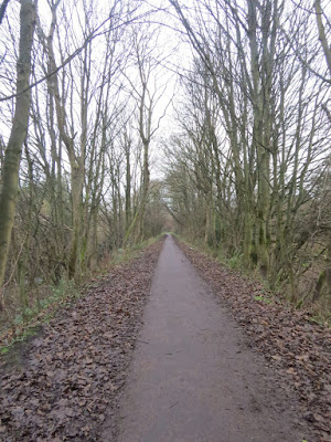 |
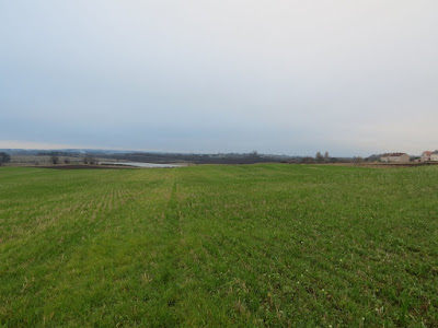
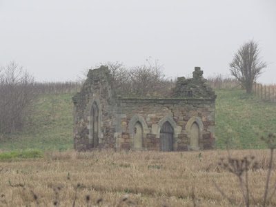
East Fife Central Railway near Windygates - NO3401
|
 |
| I had taken nearly the same photograph almost exactly a year ago. |
Last year I had broke off to the right to find Duniface trigpoint and remembered it being quite a hike to get to somewhere that looked so close on the map; I was glad I didn't have to do that today. I couldn't remember at exactly which point I had made that diversion, but knew that once I reached Maiden Castle, I was in new territory - and I always relish that feeling. As for Maiden Castle, not seen at its best on this dull and dreary day, it is traditionally associated with "Macduff, Thane of Fife," Hector Boece describing it as surrounded by seven ramparts and the same number of ditches and as the remains of the place wherefor a long time lived the descendants of the "illustrious" Macduff. (Canmore)
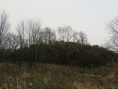 |
| Maiden Castle - NO3401 |
I might have been in new territory, but I wasn't in a new gridsquare. I bypassed with envy the obvious track leading right, which would have curtailed my walk by several miles. I discovered when I got home, that this route would have included an 'orphan' gridsquare, which is what I shall start calling those gridsquares which are left unwalked in the middle of a bunch of walked gridsquares.
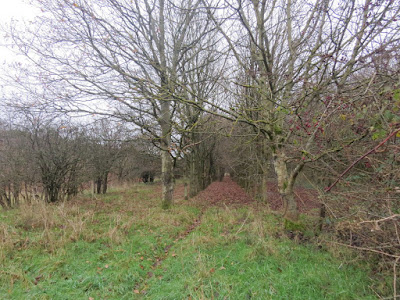 |
| EFCR south of Kennoway - NO3501 |
At times the path (and railway) were very obvious (as above), but, generally speaking, the path now became very indistinct and I fought my way through brambles and nettles to find the original railway track. "Never mind," I told myself out loud. "This is what I signed up. Ouch!" as I grabbed a nettle to hold my footing.O saw the occasional deer path through the thicket, otherwise I was blazing my own trail until I once more saw that enviable track leading to Leven. Once more I shunned it.
My determination to religiously follow the original track as closely as I knew, was abandoned when faced with a ploughed field. There was no sign of a railway through that muck, so I circumnavigated the field with as heavy a heart as the weather itself.
 |
| EFCR south of Kennoway - NO3501 (the square hedge on right is approximatel site of old railway) |
At first I thought I'd come across some artefacts of the old railway as a square shaped portion of hedge had the appearance, in the mist and murk, of the remains of a brick structure. It is unlike me to be disappointed to see natural features in place of artifical ones!
I had the distinct feeling of being watched with curiosity by the residents of Kennoway as I walked the perimeter of field after field, trying to look bold and purposeful whilst feeling more and more enclosed and disappointed as the cloud sunk lower and lower.
 |
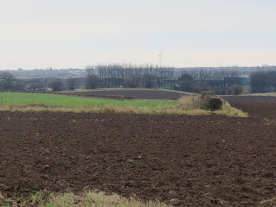
| EFCR - another field; Kennoway on the extreme right. NO 3501 |
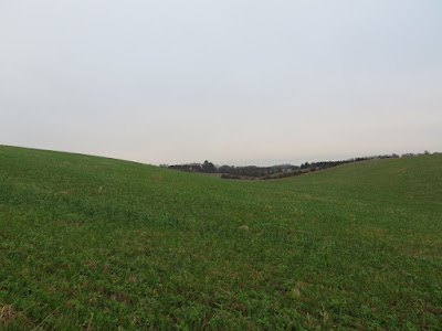
With Dembert Law and its spinney on the left and a nameless knoll on my right, I finally entered a new gridsquare and walked through the valley which I felt sure the railway would have taken as, generally speaking, railways do not go up hills, even modest ones like this - the line of least resistance and all that. Which is NOT what I was doing today!
 |
EFCR - the valley. NO3602
|
I was dancing through cropped fields, not in a lighthearted, spirited fashion, but in a heavy footed, trying to walk between crops crops fashion. I was approaching the road near Wester Durie, where there was at least some sort of track marked on the map. I was nearly there but a conglomeration of barbed wire fences stood between me and that destination. I couldn't see any gate breaking the stretched form of torture, so I got my trusty red foam mat out and nipped across into the final field and sloshed my way over to the road, once more conscious of being visible from the farmhouse. Would the excuse of searching for an old railway line hold water, I wondered, as I practiced saying it out loud (albeit under my breath).
Encouraged by a footpath sign to Bonnybank, I strode along past Wester Durie, looking surreptitiously for the benchmark which is plotted as being here. Without making myself even more obvious, I wasn't going to find that one. I quickly realised that I didn't want the footpath to Bonnybank, but had to climb over a gate in order to pursue the railway. How glad I am of Memory Map and may it long continue to work on my very old phone. I now have to carry two phones with me on these walks as Memory Map does not work on my new phone. It means my trouser pocket is very heavy and my trousers start falling down with the weight, but it's worth it!
Although not marked as a footpath, the path was very clear and I was following the route I had marked on the map, the route of the old railway, so I felt satisfied.
 |
| EFCR, Wester Durie. NO3602 |
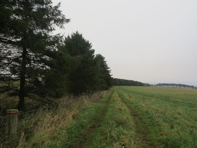
I had been heading in a northerly direction and was keen not to miss my 'turning' right. Fortunately, this was quite obvious at a line of conifers, where the path became much more grassy and less distinct.
 |
| EFCR near Balgrummo - NO3603 |
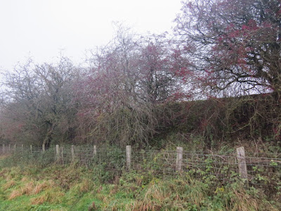
I was in the SE corner of NO3603, a new gridsquare and wouldn't be in it for long before entering the next gridsquare, of which I would walk the whole length south to north. The circular feature marked on the map at Balgrummo had long been a source of curiosity and a landmark for me when perusing the map. I was keen to see what it was like in real life.
Alas! It was not to be. as I approached Balgrummo, I saw one of the only signs of human life of the whole walk - a man walking away from me. I wondered what he was doing; I could hear an engine running somewhere too. I approached cautiously and curiously and saw a small plane in a 'hangar'. I assumed he was going to take off in it, but then thought better of that idea as why would you fly in such poor visibility ? I finally concluded he was doing maintenance work on it, although I did not linger to find out or even take a photograph as the man had disappeared and I did not fancy having to explain my presence on what he might consider his private property. I did photograph what looked like an old kiln though and took a photo of the 'hangar' from the back as soon as I dared.
 |
| Old oven at Balgrummo. NO3703 |
 |
| The 'hangar' at Balgrummo. NO3703 |
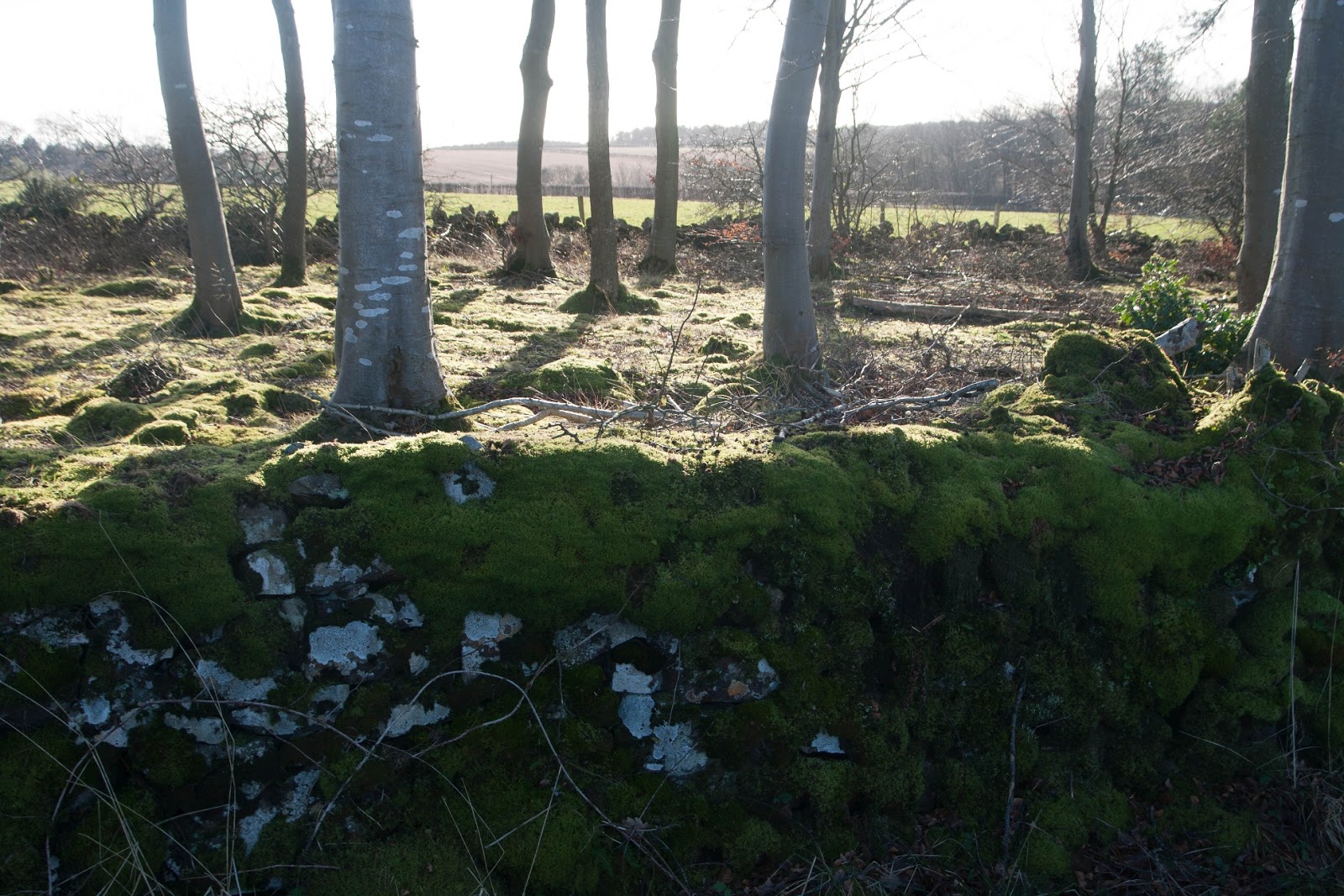
I had deviated slightly from the railway route as I hadn't fancied walking across another field. I stopped at the end of Balgrummo driveway to look closely at some moss. I hadn't allowed myself to indulge in this fascination yet on the walk and I'm always glad when I do. The miniature forest of moss is such a delight to behold, particularly through a hand lens.
 |
| Bristle Moss at Balgrummo. NO3703 |
Things continued to look up as I spied a benchmark on Balgrummo Cottages as I walked by.
 |
| Benchmark at Balgrummo Cottages. NO3703 |
I was pleased to see the first evidence of the railway north of Balgrummo Cottages and near Burnside. It was perhaps part of an erstwhile railway bridge.
 |
| Old railway bridge remains at Balgrummno Cottages. NO3703 |
The embankment of the railway continued to be obvious so I followed it as closely as I could.
 |
| EFCR embankment near Balgrummo. NO3703 |
At one point I managed to scramble up to really walk along the old railway line and I felt a sense of accomplishment, particularly as I was now in a new gridsquare. This was where the railway crossed the Letham Burn.
 |
| Where the EFCR crosses the Letham Burn. NO3704 |
This easy walking could not last, however, and not long after my sense of exhilaration came the plummet. The railway came to an abrupt end, at least the remnants thereof did. I was faced with an impenetrable thicket and a maze of badger setts, which I tentatively stepped on, hoping they were solid enough to withstand my weight. I weighed up the situation for a few minutes. I was within sight of Burnside farm behind me, so I could not walk boldly across the fields in a bid to closely follow the railway line. I had one and a half lengths of field to walk and could choose to do so either at the north end or the south. I opted for the north end and walked gradually north-eastwards towards the B927 and the end of the railway part of my walk for the day.
It was also the end of the better part of the day weather wise; not that it had started particularly well, but now I was enveloped in fog, dense fog. Plus I faced the prospect of walking down a potentially busy road with no footpath.
 |
| B927 at Letham and my onward path. NO3704 |
My turn off left was at the top of the photo where the road bends to the right. I found a path through the line of the trees on the left so it was not too bad, but was glad to turn off onto a minor road.
 |
| T-junction at Letham. B3804 |
I gradually realised that this was the road I had driven along only the day before with dad, just after we'd seen 57 Whooper Swans in a flooded field in glorious sunshine. The sat nav had taken me a weird way to Elie, but we kept saying we didn't mind because we wouldn't have seen the Whooper Swans otherwise. There were no Whooper Swans today, but he monotony was broken slightly with the sight of a small flock of Tree Sparrows.
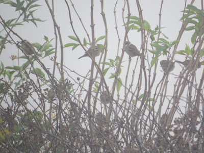 |
| Tree Sparrows near Pilmuir. NO3804 |
Several cars passed me, despite it being a minor road. Perhaps their sat navs were taking them this way to Elie too.
 |
| Road near Pilmuir. NO3904 |
I looked unsuccessfully for a couple of benchmarks along this road, but whatever they used to be on had disappeared, probably a stone wall had been replaced by a fence or stone gateposts replaced by wooden ones. Sometimes the benchmark may well still be there but covered in moss which I am loathe to tear off.
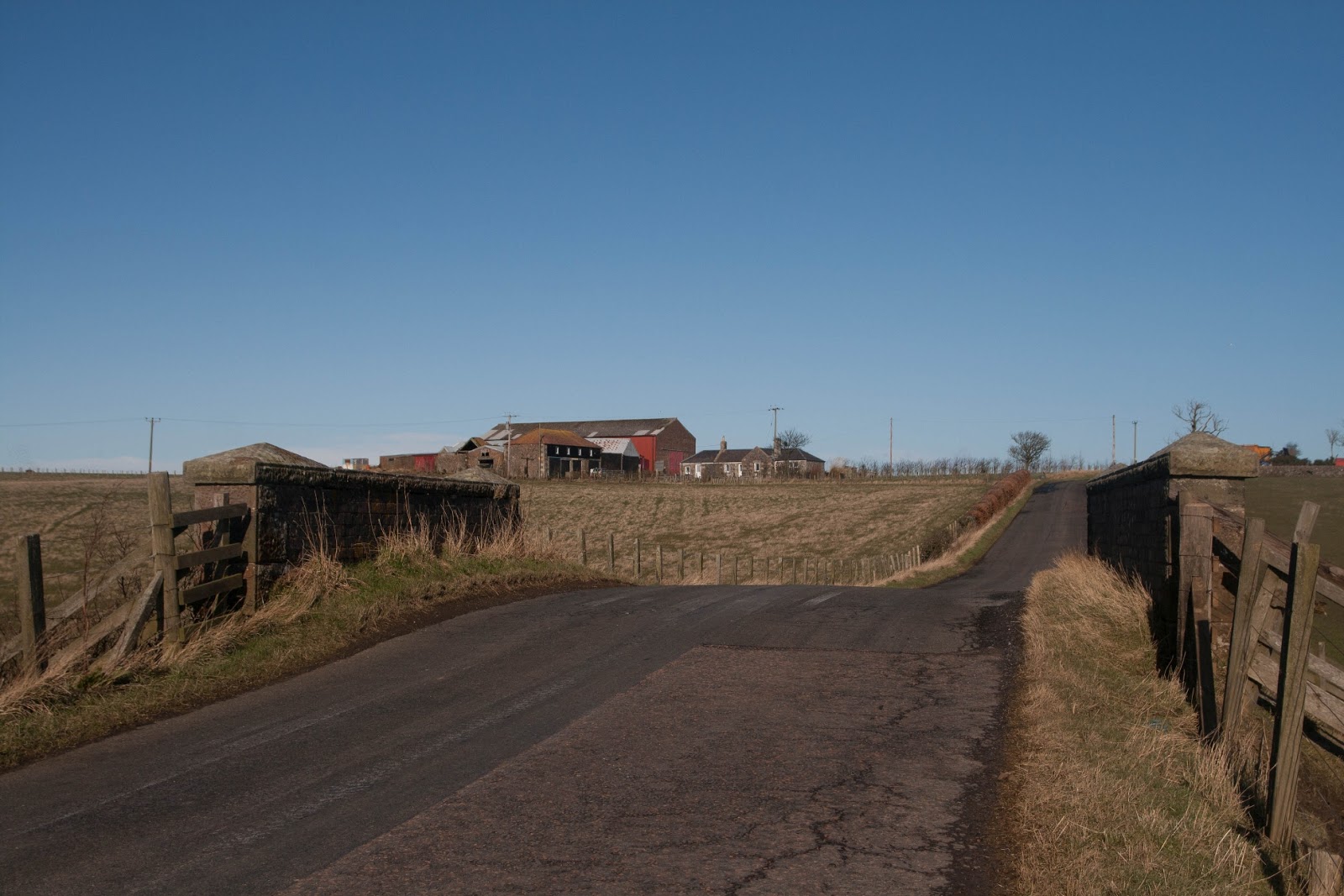
At Thomsford I took a sharp right turn and left the road dad and I had travelled to Elie. I was now near Pilmuir, a rather imposing farmhouse. I passed the time of day with one of the only people I saw that day, a farmer repairing a fence. We both commented on the state of the weather and how 'it wasn't supposed to be like this'. Perhaps it helped to know someone else was feeling the same way.
 |
| Pilmuir Farmhouse. NO3903 |
I disappeared briefly behind a wall just beyond Pilmuir, not for the reason you might be thinking of, but in search of another elusive benchmark. At times like this benchmarks can really lift your spirits, but it wasn't there to do so. I plodded on, getting weary and fed up with the weather. It's frustrating being in the office looking out at a glorious day when you're stuck inside and then, when the weekend comes, it's like this. It does no good to dwell on such thoughts, however, so I revelled in the Yellowhammers flying constantly away from me, dipping and darting into the hedge until I approached and then flying just a few yards further on. Why don't they cotton on what's happening and fly behind me instead? I wondered, not for the first time in my life!
The sight of Lundin Tower broke the monotony of the skyscape. This was a landmark I had seen many times driving to Lundin Links and I had wondered what it was. At first I had thought it was a church, but there was none marked on the map.
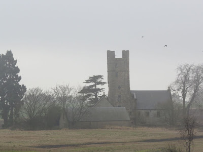 |
| Lundin Tower from NO3903 |
It was now beginning to look distinctly like a private house and my fears about walking past it germinated. They were forgotten by my search for a benchmark. "I'm never going to find this one," I muttered to myself as I glanced at the road ahead and could see no obvious benchmark location. Feeling rather dejected, I plodded on through the fog, wondering why I'd started this walk anyway. Once at the marked benchmark location I looked at the wall, barely visible through rambling brambles and luscious moss and there it was - my benchmark. Whoop! Whoop! What can be said about a person who finds such delight in these things, I wonder?
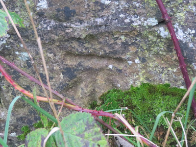 |
| Benchmark near Lundin Tower. NO4003 |
 |
| Location of benchmark - see what I mean about overgrown! NO4003 |
My delight in this benchmark was twofold; I was also in a new gridsquare, and one which I would only travel through for a distance of 684 feet (I just measured it on the map). I was now approaching my turn off, the turn off for Lundin Tower and fully expected to see a big Private sign on the gate. There was none, so I opened it and walked along the track to the building.
 |
| Road to Lundin Tower - NO4002 |
My germinated fears of NO3903 were now fully grown as there was a car parked outside the building. I did not want to walk right in front of the building. Zooming in on my phone map I looked desperately for an alternative footpath, but there was none. The only path marked on the map was the one I had taken. "Sometimes they divert the path round the back of the house," I suddenly remembered so trod lightly in that direction. Despite my fully grown fears, I spotted another building in the next field, a ruined building which looked like a tiny church. Sure enough there was a square marked on the map, but no indication of what it was. That was something for further research upon my return.
It turned out to be an elaborate doocot.
 |
| Ruined doocot at Lundin Tower. NO3902 |
I was saddened to read of this being a 'building at risk' although it is obvious from seeing it that that is exactly what it is. It has deteriorated significantly from earlier photographs and how long will it be before the large crack above the 'door' finally gives way? Click
here for more information on the doocot.
Despite its parlous state, I was delighted to discover this building as I am also 'collecting' Fife doocots, and this one is not marked on the modern map, although it is marked on the 1854 map. The gothic doocot is thought to date from the 18th century, whilst John Lamont writes of alterations made to Lundin (Lundy) House in his diary dating from the 17th 'Century:
(From The Diary of Mr John Lamont of Newton 1649 - 1671)
Lundin House was demolished in 1876 and the tower is now all that is left of this local landmark. Click here for more information on the Tower.
Apparently the 1st Independent Polish Parachute Brigade had a training tower near the doocot even though they were based at nearby Largo House. One Polish family have done some amazing research into their Great Grandfather's life in the 1st Independent Polish parachute Brigade. Apparently the concrete plinth where the tower once stood can still be seen. I would like to go back and find this. For more information about this, visit the excellent Swooping Eagle website.
Of course I was unaware of all this history as I tried to look inconspicuous and decided what to do. Continue round the back of the house and hope to find a path? Walk brazenly past the front of the house to find the path? Retrace my steps and hope to hop over the barbed wire fence somwhere?
I went for the third option and soon found myself in Lundin Wood, where I guessed I was not supposed to be, though there were no private signs.
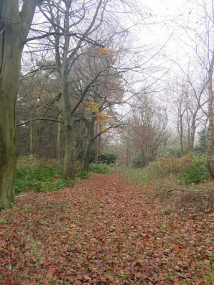 |
| Lundin Wood. NO3902 |
Relieved to have made it thus far, I waited till I was out of sight before looking for somewhere to eat lunch. I had spied a pond marked on the map, so decided to head for there and hope to find a suitable place to sit down. A boulder made the ideal option, but I did not sit for long as it was too damp and cold. I continued my journey eastwards and soon emerged at Blacketyside Caravan Park. I guessed this was where the fruit pickers stayed during the summer and wondered whether there had been any this year with the pandemic going on.
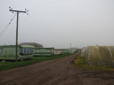 |
| Caravans at Blacketyside Farm. NO3802 |
It felt a little eerie walking through the deserted caravan site. Most caravans had bike parts in various states of decay parked outside them and the whole scene was rather poignant, particularly in the monochrome mist. I imagined a very different and bustling scene in the summer. It took a while to walk through the caravan site and the farm, but I eventually walked through a gate which warned nobody to touch it as it was 'covered in grease'. Then I was by Blacketyside House. I had had lunch at the farm shop once and knew they weren't open on Sundays and I respected that decision. Their sign apologising for not being open, quotes Exodus and the Ten Commandments which exhort us to keep the Sabbath holy.
 |
| Sign for Blacketyside House. NO3802 |
Now I was back at the B927 which I'd crossed earlier. I had been tempted then to just walk south down the road and miss out the eastern half of the walk. Despite the weather I was glad I had not done that. I just love exploring new territory and look at all the information I have gleaned from today's walk!
I was glad to see a footpath sign directly opposite the Blacketyside Farm entrance. That's always reassuring to walkers. I paused at the bridge over Scoonie Burn to look for a benchmark, even though some loud music from the nearby house told me someone was close by and I did catch sight of a figure working in his garden. I pretended I'd not seen him as I gazed intently at the bridge hoping a cut mark or rivet would jump out at me, or, even better that a Kingfisher would squeal its electric blue way by.
The former happened. Not as good as the Kingfisher, but I was delighted nonetheless, especially as it was a rivet - my favourite sort of benchmark.
 |
| Bridge over Scoonie Burn and source of loud music. NO3802 |
 |
| Rivet on bridge over Scoonie Burn. NO3802 |
 |
| Scoonie Burn. NO3802 |
Lest I was starting to feel a little zestless, a rainbow sign reminded me that things were not that bad.
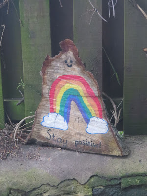 |
| Stay Positive at Coldstream. NO3302 |
The path is diverted at Coldstream - this time you do go round the back of the farm buildings to avoid walking past the house.Then I was at Tullylaw Wood and the next gridsquare.
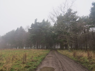 |
| Tullylaw Wood. NO3702 |
I continued on this road past Durie House, near where I met only the second person of the day, a man on a quad bike repairing fences I think. We passed the time of day and commented on the weather. I nearly didn't bother with a photo of Durie House; there seemed little point. I already had a photograph for the gridsquare; but then again I wasn't sure I'd be doing this walk again and this might be my only chance.
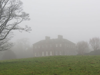 |
| Durie House. NO3702 |
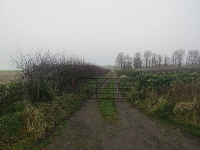
I was nearing the northern outskirts of Leven and grew anxious when the distinct path I'd been following suddenly petered out and I couldn't see a way out of the field. It ended up being another case of climbing fences and finding myself on the road between Kennoway and Leven. I could see road works ahead of me and a diversion. There was little opportunity for an interesting photo in NO3701 - by which I mean, there was no opportunity, hence my boring photo.
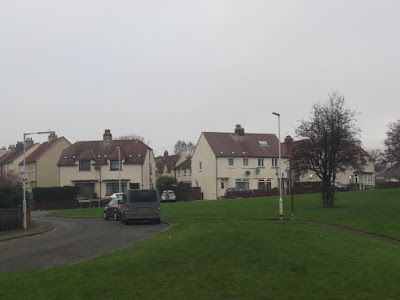 |
| Montfleurie Housing Estate. NO3701 |
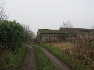
Having failed to find another benchmark, I continued southwards to rejoin my steps of almost a year ago when I had walked along this railway in the opposite direction. I didn't remember seeing the train depot on that occasion though. There were workmen on the railway tracks, confirming the rumour that the railway was soon to reopen. There was more evidence of this later on as trees and bushes had been cleared during this last section of my walk.
 |
| Train depot, Leven Heritage Railway. NO3700 |
I wasn't the only one walking along the old railway track today. Two young boys were pushing their bikes just a little way in front of me. I eventually overtook them, suddenly very tired, weary and eager to get home.
 |
| Leven Heritage Railway. NO3600 |
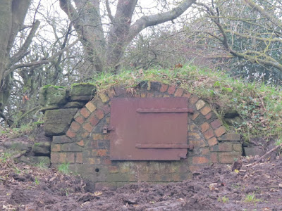
At last I was at the railway tunnel I'd seen at the beginning of my walk. I made rather a pathetic attempt at searching for the benchmark - with no luck. Then I returned to my car, the last one in the car park.
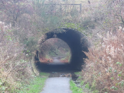 |
| Tunnel under A915. NO3500 |
Number of miles walked: 12.3 miles
Number of new gridsquares:12
Number of doocots: 1
Number of benchmarks: 3
Walk worth repeating: No, but I would like to see the concrete plinth of the former parachute training tower and look at the doocot again in nicer weather.
Highights: doocot, Lundin tower, bridge rivet