Thursday, 13 February 2025

Pivoting, riveting, flushing Kinglassie

Don't worry - all will become clear (about the title, I mean), but some of you may already have got it. Keep reading whichever category you  come into!

I agonise over a forecast before I set off on a gridsquare walk. When i'd first set aside today for my next one, the forecast had shown bright sunshine, but, by the day before, it had changed to up to 95 % rain. By that time, however, I was so looking forward to the walk that I was loathe to forego it. I checked three different forecasts and they all seemed to agree that it would clear up by 11 am.  I tried to wait that long before setting off, but it was too tough. I'm just not wired that way; if I don't get up and out by about 9 am I start losing motivation quickly.

I had cut today's walk by a third, from 12 miles to 8 miles and, after those 8 miles i wondered if I'd ever be up to walking 12 again, I was so tired and my feet hurt so much. (I haven't been able to figure out whether that's normal or not).

It was my second walk through the mining village of Kinglassie. My last one was in 2020 when I walked through it; this time I was beginning my walk there. I parked at the church.

Kinglassie Church - NT 2298

As per my last walk in Leuchars, I decided to leave the graveyard as a treat for my return to the car and set off north towards Redwells Farm. A footpath follows the Lochty Burn to Whinny Hall, but I continued northwards along a straight farm track uphill to Redwells Farm. The farmhouse stands in an elevated position and anyone looking out of the window could have watched my trudge all the way from Kinglassie to their house, and get ready to accost me upon my arrival there, for I didn't know which way I would take upon arrival.

Blythe's Tower was looming large. It was the second time I had seen it form afar, but I still had no reason to go right up to it as my first destination, East Auchmuir trigpoint was in the same gridsquare. There was not enough of interest there to tempt me to do a detour. Reading about it later, I learned it was a look out tower in WWII.

My trigpoint was west of Blythe's Tower so it would be better to continue walking west when I reached the farm, I decided. Obvious point, you may think, but this was a decision I arrived at after scouring the map and looking through my bins for any obvious access route up Redwells Hill. The track behind the farm led west so I followed thin onto the open hill and started climbing. The ground was muddy and slippy after recent rain, but I was keen to get out of sight of the farm so I plodded on as fast as I could, telling myself I would stop for a breather as soon as I reached the top of the hill.

The contours became more spaced out towards the summit and I paused at a ruin for a quick drink before continuing upwards to the trigpoint, which has its very own 'moat'. I leaned over precariously to touch the trig to officially 'bag' it!


Coffee break ruin, Redwells Hill - NT 2299


East Auchmuir trigpoint and moat with Blythe's Tower in the distance - NT 2299

Now, which way? I was heading south-west and this seemed easy enough and I started getting excited about my next two benchmarks, very close to each other, until my way was barred by a wall, an electric fence and two barbed wire fences. I walked the length of the wall to find a gate, but none could be found. I walked it again to find the easiest approach, hovering near a slightly raised lump of mud and the biggest gap between the electric fence and the barbed wire fence. It was now or never. Committing myself by flinging my rucksack over first, I placed my sitting mat on top of the barbed wire fence; it fell over to the other side. Remaining calm I gave the matter some thought. What had I got to use to cover the barbed wire? Aha, my scarf! My very long, tassly chenille scarf. bundling it up I placed it over the barbed wire and it immediately got caught in a dozen places, which I painstakingly liberated it from. I was going to have to do this the hard way.  It took some doing, but I finally got myself over that wall/fence combination, very glad that there was no-one nearby watching me.

I now had to walk back to the other wall, the one with the benchmarks. At first I could not see it and was just about to give up when a glinting piece of metal caught my eye. The rivet! I scraped some of the moss away (sorry, moss) to reveal the arrow and punched the air for joy. I had found my treasure and was likely the first person to set eyes on this little beauty for over 50 years.


East Auchmuir rivet on wall - NT 2199

My onward route looked obstacle free as far as I could see; no cattle, no fences or walls. Just straight down the edge of the field keeping my eye on the wall for the next rivet. Amazingly I found it. Wow! I was doing well today! I gave myself a mental pat on the back.


East Auchmuir rivet 2 - NO 2199


Location of second rivet - NO 2199

I wasn't so lucky with the third wall rivet, despite being determined to get three in a row! It simply evaded me and there's only so much moss clearing you can do without feeling guilty!

Reaching Kinninmonth Farm Cottages meant I had joined a tarmac road. No more barbed wire or electric fences from now on! The rain was just about holding off as I hovered round the end cottage here trying to be discreet looking for the next benchmark. This one was being guarded by a lucky horseshoe.  It was on a gatepost - another rivet. I was really enjoying myself!

The horseshoe guardian - rivet at Kinninmonth Farm Cottage gatepost - NT 2199

An auspicious moment was awaited: I was to cross the border from NT to NO (although I have to admit, I wasn't aware of the moment when I did so; I was too busy looking out for the next benchmark. I was only in the next gridsquare very briefly and there was not much nearby to photograph so I looked east and photographed Auchmuir Braes Plantation.


 Auchmuir Braes Plantation - NO 2100

Looking in vain for another rivet, I moved on quickly to the next stage of my walk - the busy road. I didn't k now it then, but the peaceful part of my walk, all two miles of it, had come to an end. There was to be brief respite for a further mile or so later, but for now I was flung onto a busy road. I have a new policy when encountering roads, busy or otherwise.  Look for an alternative route, preferably not too much of a detour. My determination to do this depends mainly on the busyness of the road in question. Is there a field or wood by which I can walk parallel to the road? The answer to this question on this occasion was a resound "No!" 

No escape - road at Craigend Hill - NO 2000

Not even bothering to look for the next benchmark I all but ran the next 50 yards or so until I reached the straight bit of road in above photo and felt slightly safer with even the option of the field on the right to walk through, which I did. In this way, hopping form one side of the road to the other, depending on which field was accessible. In this criss-crossing manner I had crossed once more back in the land of NT, having spent all of two gridsquares in NO. 

I spent ages looking for the next benchmark as it was safe to do. According to OS benchmarks it was on the west side of the road and the north side of the wall which meant I was safe in my search and hidden from oncoming traffic. To no avail! This one didn't want to be found either.

There was a nasty corner before Craigend and I took a slight detour into a patch of woodland which led down into Craigend Farm. A young man in his late teens was standing at the wall of the house, just where I needed to look for the benchmark! I wasn't missing out on another one for the sake of a bit of courage.

"Excuse me. Do you know if this property has a benchmark on it please?" I enquired. The young man looked at me as if I was speaking in a different language. He replied but I didn't understand him either. "This way?" I pointed to what i thought looked the most likely building and started wlaking towards it. "Ask my dad," he said again and pointed to the front door of the house.  Dutifully I knocked and awaited an answer from someone who looked vaguely familiar, although the feeling obviously wasn't mutual so I assume I didn't know him really.

I repeated my request to this middle aged man, father of aforementioned young man. In a friendly voice, he said he'd show me. "I'm sure I can find it," I urged but he was already putting on his boots and coat. "It's just the dog," he explained, pushing the collie into another room and shutting the door gently.

The benchmark was on the side of his house and finding it would have otherwise involved trespassing into his garden, so I was glad I'd asked.  This one is high up - over a metre above ground level, wihch is quite unusual for benchmarks.  After a short chat about the history and logic behind these marks, he wished me well on my walk and I wandered off, back onto the main road.


Benchmark, Craigend Farm/House - NT 2099


Craigend - NT 2099

Taking advantage of fields, I continued walking down this busy road.  Fortunately there were conveniently positioned exit and entrance points, so I could nip out of the field to look for the next two benchmarks, both of which were in the next gridsquare, and both of which were easy enough to spot.
One was on East Belbedie Farm and the other, a flush bracket, on Balbedie Farm.


Benchmark, East Balbedie Farm - NT 1999


East Balbedie Farm - the building with the benchmark - NT 1999


Balbedie Farm - NT 1999


Balbedie Farm flush bracket - NT 1999

For anyone who has not given up reading yet, are you beginning to see the reason for my post's title? I understand that probably it's been a bit tedious. All I've talked about is gridsquares and benchmarks, which are definitely a bit well, niche, but that's what this blog is all about. And, to be honest, there wasn't a lot else to say about today's walk.  But I had collected 2 flush brackets, 3 rivets and 2 cut marks. That was above average for one of these walks. Now can you see the reason for my excitement?

I was now about to cross Fife's boundary into Kinross-shire, another exciting moment.


Cheerio Fife and hello Kinross-shire - NT 1999

In the photo, you can see just opposite the car, a turning to the left. What you can't see is the car transporter and various cars that had been sitting there since I'd left Balbedie. It was making me a bit nervous. I had to turn down that road, just for the tiniest wee bit just to get another gridsquare. I would be in the same gridsquare later on, but I wouldn't be in Fife. I also had to take a photograph of the right road, the left one, when I did reach a certain point within the gridsquare. perhaps you can see why i often go alone on these walks!

I walked brazenly past a host of signs which looked very off putting. This was the road I had wanted to take all the way down to the B9097, but I had chickened out when curtailing my walk on the computer earlier this morning. Walking through Westfield Development Centre just didn't appeal and might not be allowed, so I had come up with a longer, circuitous route which detoured into two gratuitous, Kinross-shire gridsquares.


The road on the left follows the Fife/Kinross border, the road on the right leads to Manorleys and is just within Kinross-shire - NT 1998

I was getting fed up of road walking by now and, seeing a grassy track to the left, I darted into it and next to a disused quarry. I decided this was an ideal spot for my much needed lunch. There was even a lovely rusty piece of farm machinery lending several perches for me to sit down. Tempting though that was, I didn't fancy tipping the whole thing over on top of me so opted to sit on a raised piece of ground instead where I could admire said piece of rusty machinery.

Rusty quarry  machinery - a tempting perch for lunch - NT 1998

 
Lichen on old quarry machinery - NT 1998

I enjoyed being away form the road and realised I could continue through this disused quarry in the desired direction towards my next benchmark, the one I was very excited about.

The first ruin I came to was benchmarkless. Not named on the map, I later discovered it is called Skellyheads Farm and it consisted of at least two ruined buildings. There was not much to see here, but I did notice the overhanging window ledge and read later it was thought this indicated the existence of a pigeon loft.

Skellyheads ruin - the overhanging window ledge is on the right hand gable (but not really visible in the photo) - NT 1898

Gaining access to the next ruin was oigng to be problematic. I could see that form some distance. I could also see that it was a substantial ruin.  This was Kirkness House. And this was where I was going to find my first ever pivot. I couldn't possibly let this one get away from me, electric fence or no electric fence! What is it with electric fences? There was no stock in the field, yet both barbed wire and electric fences surrounded these old ruins preventing me from entering.

As it happened I didn't need to; this glorious pivot benchmark was situated on the north facing turret-like windowsill. Proud as punch. Woohoo! I was ecstatic, yet ever so slightly dampened by the fact that I couldn't get to actually touch it and determine what made it a pivot and not a rivet!


Kirkness House ruins, Kinross-shire - the windowsill with the pivot on it is the bottom right - NT 1898


Pivot on windowsill, Kirkness House - NT 1988

I spent quite a lot of time searching for the next benchmark in the wall just before Middleburn. I could see someone watching me and avoided their gaze. Trouble was I had to nip underneath a barbed wire fence to get back on track and then look non-chalant as if nothing had happened.

Ken to get back into Fife, I took a left turn at Middleburn Crossroads onto another very busy road, the B9097 on which I would remain for at least two miles. My tactic at moments like this is not to dwell on the misery. It doesn't do you any good when there's no way round it. I go through various alphabets to keep myself amused when I'm not birdwatching (nothing in sight) or benchmark watching. Often times of course I get myself into various mini scrapes just by being stubborn.

"I don't want to walk on the road," I announced and stubbornly dived off into the undergrowth out of sight of the road by a ditch on a steep incline full of brambles litter and yes, another barbed wire fence. At least I'm not on the road, I told myself a dozen times as I untangled one accoutrement after another caught on various overhanging branches. At last I admitted defeat and emerged back onto the road, none the worse for wear and appearing non-chalant once again.

Glad to be back in Fife I took a photo of the sign for Westfield Development Centre (as it was on my map, but now Westfield Energy Re-generation.


Westfield Energy Regeneration - NT 1897

This was where I would have turned up if I'd taken the aforementioned shortcut. Oh well, I'd never have to do this walk again so wouldn't need to remember it. (I'm pretty sure you're not allowed to wander into this place anyway.)

My feet had been complaining for some time now, but again I tried to focus on anything but my feet, like the lovely scenery! The next gridsquare. There were no benchmarks to worry about for ages yet. I snapped the electricity sub station for square NT1997 and soon came across, believe it or not, a pavement for cyclists and pedestrians. Why, was a mystery to me!

Electricity sub station - NT 1997


Pedestrian and cycle crossing on B9097 - NT 2097

All the way along the north side of this road were signs saying Keep Out. This was Opencast Workings. In fact I had basically circumnavigated the workings, complete with four reservoirs.  In fact, there is one square I can foresee having trouble getting into, but that will be a worry for another day.

For now I had to take my weary feet onwards for another two miles or so, to another gate where I was tempted to take a shortcut, but feared it might not work out.


Gate near Strathruddie - NT 2197

I realised then that I was going to bag a bonus square at the T-junction, as long as I went as close to the road as was safe to do, which meant walking a tiny bit further than I needed to (naturally!)


T-junction - NT 2196

I was on the homeward stretch now with just two gridsquares left and not as many miles.  I was getting tired and annoyingly photographed Strathruddie House (NT 2197) instead of its featureless entrance (NT 2297). I'll have to go back now!


Strathruddie - NT 2197 (oh no, I took the wrong square!)

I told myself I'd stop at the cemetery where I could see I'd plotted another benchmark.  This proved to be too dangerous to  look for, however, but I did take refuge in the cemetery where I sat on a bench and drank some more tea.

Relieved, I stumbled  into Kinglassie and photographed my final gridsquare of the day.

Welcome to Kinglassie - NT 2298

I was not done yet, however.  There were still two benchmarks to get and I did this before ending up at the small churchyard with the final dregs of my flask. Weary footed but delighted with my cache today in pivoting, riveting, flushing Kinglassie!

Benchmark on bridge over Lochty Burn - NT 2298


Lochty Burn, Kinglassie - NT 2298


Benchmark on school, Kinglassie - NT 2298


Kinglassie Church - NT 2298

Total miles walked: 8
Total number of Fife gridsquares gained: 13
Total number of Fife gridsquares possible: 14
Total number of gridsquares walked: 15 (1 in Kinross)
Total number of benchmarks: 10 (1 pivot, 1 flush bracket, 1 trigpoint, 3 rivets, 4 cut marks)
Total number of electric fences: about a million
Highlights: Finding the pivot benchmark and the rivets
Walk worth repeating: to get the missing gridquare only and possibly a closer look at Kirkness House

Monday, 10 February 2025

Loud but not so clear in Leuchars

There are some walks I complete and have to say 'Never again'. With apologies to all residents and natives of Leuchars, I have to say this is one of them. Let me explain.

Probably only geographers and benchmark geeks like me will get this, but I get an adrenalin rush when plotting my gridsquare and benchmark walks. Yes, I know that is a huge confession and probably my following of 2 may now have halfed again, but it is true. Whatever else the walk will or won't deliver, at the very least I am going to bag probably all of the gridsquares plotted and up to a quarter of the benchmarks plotted. Anything else is a bonus.

So I set off  with this mindset today and parked near Leuchars Church, St Athernase. I hadn't actually ever got the benchmark on this church, although I had visited a long time ago when researching my dad's Covenanting project. More on that later. For now, with adrenalin flowing fast and furious I got myself booted and strapped up and wandered round in circles getting my Memory Map to sync and tell me which way to go.

"I'll get these two benchmarks out the way first," I decided when I eventually got my bearings and walked in the opposite direction to that which  my walk was going to take me. Then I changed my mind (one of the great bonuses of walking alone). "Better not," I told myself, "Leave it as something to look forward to at the end of the walk." About turn! And with phone in hand, I turned around only to hear a voice from the opposite side of the road call out,,

"It's the other way you're wanting!" Had he been watching me all this time? I looked in the direction of the voice and an elderly gentleman who probably thought he was doing me a favour pointed back in the direction I had just shunned.  "The footpath goes that way," he repeated. "Thank you very much, but I want to go the other way," I said, trying to hide my annoyance.  I pointed to my phone, "I've got a map," I added for reinforcement. Undeterred he tried to persuade me that I wanted to go the other way and, undeterred, I thanked him again and started walking off whilst he muttered that I was walking in the direction of the main road.

Now I know folk are only trying to help, but how did he know where I wanted to go? I hadn't asked him for help. he hadn't asked me if I needed it. He'd just assumed and sometimes, well, I can't be bothered talking to folk like that. I have a walk to get on with. I hope that doesn't sound too Wainwrightish, because I can be pretty pleasant if I encounter nice folk on my walks!

Away now from prying eyes, I headed westwards and, yes, towards the main road, but turning off north-eastwards at the roundabout in the village. "Phew, away from that noise," I said to myself as I photographed an interesting conglomeration of what looked like a lockdown project.


Lockdown Bar, Leuchars - NO4521

Not for the first time I mused away at another of my many book ideas, which I don't mind sharing here as I've got so many that I'm never going to get round to half of them. The idea is to write a book on some  interesting projects undertaken by people during the COVID lockdowns. There's no doubt folk discovered or harnessed their creative skills during this period and I've heard of quite a few projects just through the radio and word of mouth. I think it would make interesting research to collate more such stories and perhaps remind us all that at one time in our history, not so long ago, many of us vowed that we would not return to 'normal' and, for most of us, lamentably, we have done just that.

Walking along a disused railway line I was relieved to see many other footprints, suggesting this was indeed a well-worn footpath. Despite many years of walking, I'm always relieved to discover that I'm not 'trespassing'. I can relax into the walk and not be rehearsing my lines of defense should I be accosted by unfriendly landowners. I was not so relieved to discover that this was also a local dog toilet with dog mess scattered all over the place. Disgusting!

I was walking along the disused Edinburgh and North Railway with a clear and muddy vehicle track following the railway and a ditch to my left as I walked north. An oval shaped mound on the opposite side of the ditch caused me to check my map. This was Castle Knowe Motte and definitely worthy of a photo.

Castle Knowe Motte - NO 4521

Castle Motte is an oval, flat-topped mound, measuring 100m by 70m by c.8m high. A quantity of building material and oyster shells occurs on the surface, and a number of stone blocks have been placed among two clumps of trees on the mound. The site was originally a mote-hill, with a summit 100 yds long by 60 yds wide and 25ft high, which was later crowned by a stone castle, occupied at least as late as 1565, and part still standing at the close of the 18th century. A moat surrounded the site. (Info from Canmore)

My walk now was straight and pretty featureless, simply following the railway line through another three squares.


Approaching Cast Wood - NO 4522


Looking across to St Michael's Wood - NO 4523


Near Rhynd - NO 4623

I love it when I can get two squares within five minutes of each other, and that is what happened with NO 4623 and NO 4624 as I cut through the top left hand corner of the former square and entered the latter square at the bottom left hand corner.


Onto Tentsmuir Road - NO 4624

Although I have driven along this road many times to reach Tentsmuir Forest, I have never walked along it and therefore did not recognise it at first. That's what often happens with a familiar route. I plot the route on the map without realising that it is on roads with which I am very familiar. Sometimes it takes a while for the penny to drop. In this case it was the amount of traffic on what seemed to be a very minor road that raised my suspicions. Then I reaslied why; it was the popular road to Tentsmuir.

At Craigie Roadside Cottages I was pleased to spy an easy benchmark on a gatepost, meaning I didn't have to lean over the gate or go up the drive to ask the man cutting firewood if I could photograph his benchmark.


Craigie Roadside Cottages - NO 4524. The benchmark is on the right hand side gatepost in the photo


Benchmark, gatepost, Craigie Roadside Cottages - NO 4524

For the next short bit along the road, I was dodging horses and cars and looking ahead to see if I could see the trigpoint.  It had been a long time since I'd done a new trigpoint and I was quite excited about it. Perhaps I'd be able to have my first stop there as I hadn't seen anywhere suitable to sit down yet - and I have a musing that one has to sit down if one is partaking of food or drink (although I have once or twice broken my own rule and my brother breaks it all the time).

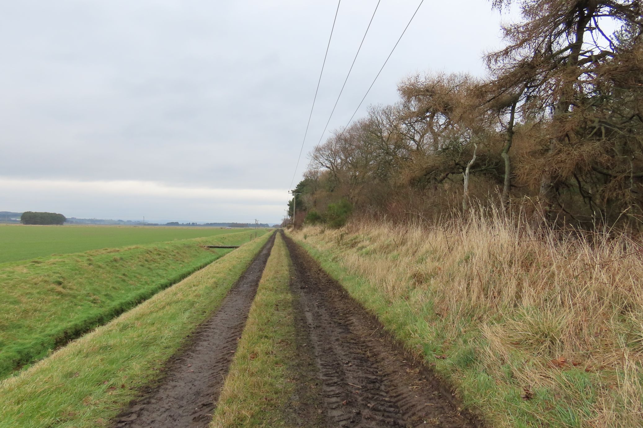
Once in NO 4424, I looked briefly for a benchmark which I fear may have been destroyed along with the ruinous wall that runs alongside the B945. It was too dangerous to stand by the side of the road stamping down vegetation, so I gave up after just a couple of minutes and decided to fight my way up the steep hill towards the trigpoint rather than follow the obvious path.

After about five minutes of slipping and grabbing tree trunks, I emerged at a barbed wire fence, beyond which had a familiar look about it. Was this a country estate? I found a part of the fence with no barbed wire and hopped across it onto, no, not a country estate but a golf course! Wretched thing! Why put a golf course around a trigpoint or put a trigpoint in a golf course (not sure which came first). Closely following my memory map for navigation, I waited for a group of golfers to tee off before walking boldly in the direction of the trigpoint, only to find it wasn't in that direction. I changed tack and continued south-westerly to another clump of bushes which I reckoned might be hiding the trig. I wasn't about to give up now, no matter how hard the golfers stared!

But there's only so much feeling uncomfortable you can put up with and I'd reached my limit. I sneaked back down from the bushes to where I considered a safe distance from the course and pulled out my sitting mat, flask and biscuit.  Feeling disappointed that the trig had disappeared I remembered another occasion when I had felt exactly the same. And what had happened? I'd gone back home and realised I'd missed the trig by a matter of a few feet!

Hearing golfers' voices above me, I cowered down and pulled out my phone to log into the Trigpointing UK website, where I saw photos of an unobscured 'easily accessed' trigpoint right here. But where? I asked myself aloud.

Right, that does it. I'm not leaving here until I find it, I resolved and got up and continued walking. How could I miss a near four foot of concrete? I came round the corner and there it was! At the junction of two paths. Quickly I snapped the requisite photos and made a hasty retreat. if I never saw another golf course, it would be too soon.


Craigie Hill trigpoint - NO 4424

I didn't like the thought of going back the way I had come, but the alternative was to nose dive off a very steep cliff onto the road and walk back along the busy road, which was an even less appealing prospect. So I grinned and beared it, making as much haste as I could and soon found myself back at the entrance to the Tentsmuir Road. This was the only bit of my walk today which wasn't strictly speaking circular, but I'd made the detour in order to bag the trigpoint.

I walked back to Craigie Farm, where I took a right turn past Red Row Cottages and into my next gridsquare, NO 4423. For a minute it looked like I was wandering into someone's garden, but the path opened up and entered St Michael's Wood, where I felt sure I would find somewhere to eat my lunch.


St Michael's Wood - NO 4423

My desire for tranquility after the golf course was thwarted by the felling of trees I could hear to my right. Same as I'd heard at Rhynd Wood earlier (and forgot to mention, but important for the title of this post).  Not wanting to sit with that noise in my ears, I plodded on, hearing and seeing little.  I emerged back on the B945 I'd crossed earlier and immediately started looking for the next benchmark. Ah, there it was on the wall of a house - The Hermitage.


Benchmark on Hermitage, St Michael's - NO 4422


Hermitage, St Michael's - NO 4422

This was another road I had driven along many times and I had eaten in the pub, St Michael's Inn on once unforgettable occasion when we were doing a 24 hour Fife Bird Race.  Little did I know then that the pub boasts a flush bracket. My second of the day. All I had to do was cross this crazily busy road to get to it and then work out which way to go next.


St Michael's Inn - NO 4422

I had all but given up on finding this flush bracket when I resorted once more to my trusty website where I was informed it was on the north-west face of the building. A quick reckoning told me this was the right hand side (in above photo) and lo and behold there partially hidden by wooden fence you can see in the photo, was a heavily painted flush bracket.


Flush bracket, St Michael's Inn - NO 4424

I was tempted to go and buy one of those  hot air paint strippers to allow the poor flush bracket to breathe again but thought that might actually cause more damage than good, so had to wish it well and leave it suffocating and under-appreciated at this busy road junction.

I was heading south, under a railway bridge where I looked for another benchmark, but couldn't see it and felt too conspicuous and unsafe clearing vegetation to look more earnestly for it.  I was also conscious that I was on an even busier A road and that the pavement I was walking on couldn't possibly last much longer. I was right; it lasted as far as Burnside house and then petered out.  There was a footpath sign, however to the left heading for Leuchars via 'The Coffin Road', which sounded intriguing.  If I took that path, I would avoid having to walk along the A road, but I would also miss out on a further two gridsquares.

It was a no brainer really. I opted for the footpath. I'd have to work in the other two squares some other time. I walked through woodland and uphill to another distressingly familiar sight - another &&**"" golf course! How many of them are there here? Can't you walk anywhere without risking being massacred by chain saws or hit on the head by a stray golf ball or treading in mounds of disgusting dog dirt?  Annoyed I puffed and panted my way along the edge of the course, desperately searching for the footpath signs. It had clearly said this was the footpath to Leuchars, so where was the next sign?

I ended up asking a couple of players who pointed me in the right/wrong direction. "You see that yellow flag there?" One of them asked, pointing to a bright yellow flag that was just being uprooted from its lodging. "About opposite that flag there's the footpath, which will take you down the hill."


Relieved, I quickly crossed the golf course and walked along some rough ground towards the yellow flag which was being repositioned by two more players who seemed to take ages to tee off to the next hole. Was it because they could see me lurking in the bushes to their right? Feeling distinctly uncomfortable for the second time that day, I patiently waited for them to 'just go' (muttering inaudibly to myself). After an age of practicing, they finally got the ball off the tee and walked, very slowly, on. They definitely knew I was there! I ran across the course again to where I could see a small stile.  A man with an Alsatian was walking brazenly towards me with no apparent concern that he too was on a golf course. Finally, I was at the stile where I paused to take a photo, which, under normal circumstances, I would never bother with. Then I nipped over the stile into freedom and peace, at last!


Gallow Hill Golf Course on a thankfully quiet day - NO 4421

But something wasn't quite right, this was not the direction I wanted to go. This was the direction I had just walked from! I had to cross that **$$$££** golf course again. There was absolutely no signage to help, so I trotted across the golf course, trying to remain incognito with my camera, binocs and huge rucksack to where I could see the CH (Clubhouse) and a thousand cars. And a cemetery. At last! Somewhere I could eat my lunch in peace.

Rarely have I felt more relieved to walk through gates. My relief was short-lived, however and I'll tell you why in a minute.

For now I can draw breath again, I will tell you about the Coffin Road in case you're not familiar with the concept. Interestingly the golf course I had crossed was on Gallow Hill, presumably the historic place of execution for the town of Leuchars. Aside from that, the route I had just taken (without the detours) was once the route used to carry the dead in their coffins to the cemetery. There is a beautiful description of this rite here.

Once inside the gates of the cemetery I placed my mat on the first bench and got out my flask and lunch. There were only two other people in the cemetery who seemed to be doing some strimming as there was a rather irritating noise coming from their direction. The noise continued after they had left, however. It was rather like a mosquito buzzing round your ear. After lunch, I quickly walked round the cemetery in search of any interesting graves. One in particular stood out, dedicated to a 'stargazer'.


Stargazer's grave, Leuchars Cemetery - NO 4421

The dragon engraving and quote at the bottom also caught my eye. "It simply isn't an adventure worth telling if there aren't any dragons." The first time I'd ever seen a dragon on a grave! When I got home, I did some research and discovered this quote, which is usually attributed to J R R Tolkien, is in fact from a book called Simple Abundance by Sarah Ban Breathnach. Although not a great fan of dragons, per se, I rather like the notion behind this quote - that you've got to have adventure in your life to spice it up a bit or, as Tolkien does advise, “It does not do to leave a live dragon out of your calculations, if you live near him.” 

I certainly felt as if I had met one of my dragons today and I could still hear it breathing loudly somewhere not too far away. As I left the graveyard, I made my way up to the war memorial where the mosquito noise was reaching screaming pitch.


War Memorial, Leuchars - NO 4421

Then I discovered the source of the noise. Scramble bikes. Another thing I fail to see the attraction of. I found the noise unbearable and the sight of machines tearing up the countryside always disturbs me. Yes I know it's better to have a designated place for such activities to stop them using any and every available corner of earth to disturb the peace, but it's a bit like dog mess. Designated places or not, there will always be those who choose not to use those designated places.

You can tell how much I enjoyed today's walk, can't you!? I tore down the hill as fast as I dared, using the field next to the scramble bike field for obvious reasons. I was heading unavoidably towards about 20 large vehicles (large enough to carry the bikes). I felt  uncomfortable for the third time that day. The noise went right through me, loud and screeching and coming from all directions as the bike trials were being held in more than one field. It was horrendous.

I walked south towards Leuchars station and into the next grid square - just, before turning sharply north-eastwards on a track back to Leuchars, with the sound of the bikes ringing in my ears.


Leuchars train station - NO4420

I had completed my gridsquares and done a full circle back to Leuchars. Walking under the railway bridge, I re-entered the village where I took a deliberate detour to bag another flush bracket, my third of the day, this time on a former masonic lodge.


Former masonic lodge, Leuchars - NO 4521


Flush bracket on masonic lodge, Leuchars - NO 4521

I hadn't forgotten about my vow to return to the other two benchmarks, the ones I'd decided to leave till the end of my walk. I wandered up to St Athernase Church and sat on the bench with my final cup of tea of the day. Circumnavigating the church, I finally found the bolt benchmark and then another on a nearby cottage.


Benchmark, #2 Main Street, Leuchars - NO 4521


Bolt benchmark, St Athernase Church, Leuchars - NO 4521

I was relieved to get back inside my car - away from bikes, chain saws and golf balls. I think with all confidence I can say that I will never repeat this walk, but I did see the following in recompense for my trouble:

Number of new gridsquares: 11
Number of anticipated new gridsquares: 13
Number of trigpoints: 1
Number of benchmarks: 6 (3 FBs, 1 bolt, 2 cut marks)
Number of anticipated benchmarks: 9
Number of golf courses: 2
Number of nosey parkers: 1
Walk worth repeating: Definitely not
Highlights: Erm, the Stargazer's grave, Leuchars