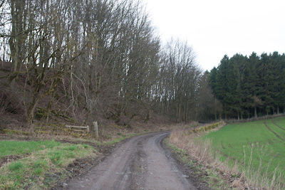
We parked at a small lay-by by the village of Glenduckie; the weather was overcast, but dry, so we knew we would not get exceedingly good Mr Kipling type views from the mighty summits, but that just means returning, and it is a walk worth returning to.
The tiny hamlet of Glenduckie nestles below Glenduckie Hill.
 |
| Glenduckie and Glenduckie Hill - NO2818 |
 |
| Glenduckie Hill Summit - NO2819 |
A barn made a good subject for this gridsquare's photograph, although the footpath was lined with cheery snowdrops and Lesser Celandine. How welcome these bright little flowers are after the dull winter.
 |
| Barn near Glascairn. NO2919 |
 |
| Footpath at Glascairn - NO2919 |
 |
| Snowdrops and Lesser Celandine at Glascairn. NO2919 |
 |
| Glascairn Cottages. NO2919 |
 |
| Glenduckie Hill from Glascairn. NO2919 |
We continued eastwards into the next gridsquare, which I decided to leave until our descent back through the same gridsquare. At some point we scared a Woodcock from its slumber and it flew up soundlessly from just under our feet, giving us a bit of a scare.
And so we meandered onto the summit of Norman's Law at its mighty height of 285 metres. It is a marilyn, "a hill of any height with a drop of 150 metres (nearly 500 ft) or more on all sides". This means it is relatively high in comparison with its surroundings. There were certainly excellent views all round from the summit, north to the Tay and south to the distinctive landmark of Hopetoun Monument (although we didn't know what it was at the time) There is a toposcope here with directions and mileage to distinctive landmarks viewed from here. I always like studying these things and trying to make out the various lumps and bumps visible.
 |
| Norman's Law summit - NO 3020 |
Again we followed our noses searching for the path on the east side of the hill which would lead us southwards to Denmuirhill. It felt good to be making our own tracks again, to be wandering at will, rather than having to stick to the restrictive footpaths south of the border. It made for harder walking though - all good exercise of course!
At Denmuirhill we came across a strange structure - a stone wall with a line of iron pulleys. We later discovered this was an erstwhile WWI rifle range.
 |
| Pulleys and remains of WWI rifle range at Denmuirhill. NO3019 |
 |
| Norman's Law from the south. NO3019. |
We walked to the west of Whirly Kipps hill and pondered on its unusual and rather attractive name. Apparently whirly means 'puny' or shrunken and 'kips' means projecting points of a hill, so it is not a very complimentary name. There is another hill of the same name to the north of Norman's Law. A ruin reminded us once more of times past; perhaps this was something to do with the rifle range. I can't think it was a dwelling place contemporary with the rifle range as that would be just too dangerous!
We walked past the farm at Denmuir, with some buildings in a ruinous state.
Between Denmuir and Ayton we passed a carpet of Snowdrops and Lesser Celandine, which was truly spectacular.
 |
| Ruin at Denmuirhill with Norman's Law in the background. NO3019. |
We walked past the farm at Denmuir, with some buildings in a ruinous state.
 |
| Denmuir farm. NO3018 |
 |
| Snowdrops and Lesser Celandine near Ayton. NO3018. |
The Snowdrop
Lord Alfred Tennyson
Many, many welcomes,
February fair-maid,
Ever as of old time,
Solitary firstling,
Coming in the cold time,
Prophet of the gay time,
Prophet of the May time,
Prophet of the roses,
Many, many welcomes,
February fair-maid!
Another unusual feature attracted our attention at Ayton, a type of water wheel in the garden.
 |
| Water wheel at Ayton. NO3018. |
I only had one gridsquare left and there was nothing of particular note within it, so I snapped boring shot
of the road as we walked back uphill to rejoin our route at Glascairn.
 |
| Road at Broomhill. NO2918. |
We now retraced our steps back to the car, our route resembling a mirror image of the map of Britain with a ball and chain!
Number of new gridsquares: 7
Number of hills climbed: 2
Walk worth repeating: yes


